Annapolis Overlook in Anne Arundel County, Maryland — The American Northeast (Mid-Atlantic)
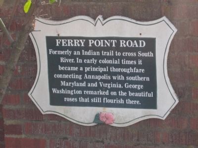
Ferry Point Road
Topics. This historical marker is listed in these topic lists: Colonial Era • Native Americans • Waterways & Vessels.
Location. 38° 57.019′ N, 76° 31.678′ W. Marker is near Annapolis, Maryland, in Anne Arundel County. It is in Annapolis Overlook. Marker is on Ferry Point Road, 0.9 miles west of Spa Road (Maryland Route 387), on the left when traveling west. Touch for map. Marker is at or near this postal address: 440 Ferry Point Rd, Annapolis MD 21403, United States of America. Touch for directions.
Other nearby markers. At least 8 other markers are within walking distance of this marker. The Ferry at London Town (approx. 0.9 miles away); London Town Ferry (approx. 0.9 miles away); William Brown House (approx. 0.9 miles away); London Town Publik House (approx. 0.9 miles away); Scott Street (approx. 0.9 miles away); Archaeology at London Town (approx. 0.9 miles away); Establishing a Colonial Town (approx. 0.9 miles away); Dr. Hill's Medicinal Plants (approx. 0.9 miles away).

Photographed By F. Robby, January 28, 2008
2. Ferry Point Road Marker
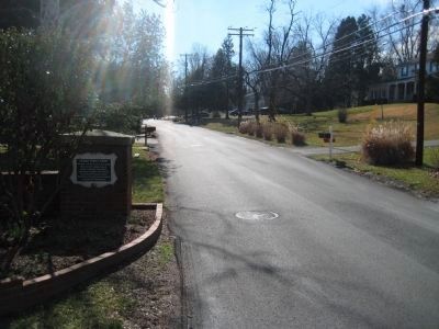
Looking down Ferry Point Road in the direction of the South River. The waterfront is not accessible to the public. Directly across the South River is London Town, a "lost" colonial town and site of several markers, including one for the London Town Ferry which connected with Ferry Point Road.
Credits. This page was last revised on September 10, 2023. It was originally submitted on July 18, 2008, by F. Robby of Baltimore, Maryland. This page has been viewed 1,459 times since then and 26 times this year. Photos: 1, 2. submitted on July 18, 2008, by F. Robby of Baltimore, Maryland.
