Charlotte Hall in St. Mary's County, Maryland — The American Northeast (Mid-Atlantic)
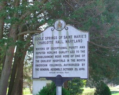
Coole Springs of Saint Marie’s
Charlotte Hall, Maryland
Erected by the Maryland Historical Trust.
Topics and series. This historical marker is listed in these topic lists: Natural Resources • Science & Medicine. In addition, it is included in the Daughters of the American Revolution series list. A significant historical date for this entry is October 20, 1723.
Location. 38° 28.672′ N, 76° 46.656′ W. Marker is in Charlotte Hall, Maryland, in St. Mary's County. Marker is on Charlotte Hall Road south of Charlotte Hall School Road, on the left when traveling south. It is behind the St. Mary’s County Welcome Center on Route 5, which runs parallel to Charlotte Hall Road. Touch for map. Marker is in this post office area: Charlotte Hall MD 20622, United States of America. Touch for directions.
Other nearby markers. At least 10 other markers are within 4 miles of this marker, measured as the crow flies. Cadet Pierre A. Mourthé (within shouting distance of this marker); Ye Coole Springs (within shouting distance of this marker); Charlotte Hall School (within shouting distance of this marker); No Match for British Might (about 400 feet away, measured in a direct line); Maryland Begins Here (about 400 feet away); a different marker also named Charlotte Hall School (about 600 feet away); Village of Charlotte Hall (approx. 0.2 miles away); Amish Community (approx. 0.3 miles away); Managing The Line (approx. 0.9 miles away); Village of Mechanicsville (approx. 3.2 miles away). Touch for a list and map of all markers in Charlotte Hall.

Photographed By Tom Fuchs, March 31, 2007
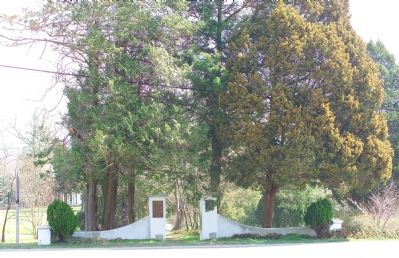
2. Gateway to Coole Springs
The marker is in profile on the extreme left. The gateway was erected by the Daughters of the American Revolution in 1923. It faces the Charlotte Hall School gates across Charlotte Hall Road. The plaque on the left gatepost is the Raphael Semmes Marker.

Photographed By J. J. Prats, March 31, 2007
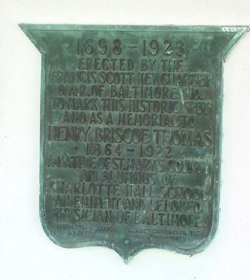
3. Right Gatepost Plaque
The plaque reads: “1698–1923. Erected by the Francis Scott Key Chapter, D.A.R. of Baltimore, Md. to mark this historic spot and as a Memorial to Henry Briscoe Thomas, 1864–1922, a native of St. Mary’s County and Alumnus of Charlotte Hall School. An eminent and beloved physician of Baltimore. Fanny Combs Couch, Regent; Harriet Garland Twisley, Chairman.”
Credits. This page was last revised on June 16, 2016. It was originally submitted on April 8, 2007, by Tom Fuchs of Greenbelt, Maryland. This page has been viewed 2,668 times since then and 76 times this year. Photos: 1, 2, 3, 4. submitted on April 8, 2007, by Tom Fuchs of Greenbelt, Maryland. • J. J. Prats was the editor who published this page.
Editor’s want-list for this marker. Photo of the spring • Can you help?

