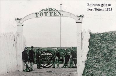
Fort Totten in Northeast Washington in Washington, District of Columbia — The American Northeast (Mid-Atlantic)
Fort Totten
Rock Creek Park
— National Park Service, U.S. Department of the Interior —
Erected by National Park Service, U.S. Department of the Interior.
Topics. This historical marker is listed in these topic lists: Forts and Castles • War, US Civil. A significant historical year for this entry is 1861.
Location. 38° 56.923′ N, 77° 0.331′ W. Marker is in Northeast Washington in Washington, District of Columbia. It is in Fort Totten. Marker can be reached from Fort Totten Drive Northeast north of Crittenden Street Northeast, on the right when traveling north. Touch for map. Marker is at or near this postal address: 4810 Fort Totten Drive Northeast, Washington DC 20011, United States of America. Touch for directions.
Other nearby markers. At least 8 other markers are within walking distance of this marker. A different marker also named Fort Totten (within shouting distance of this marker); a different marker also named Fort Totten (about 500 feet away, measured in a direct line); St. Paul's Episcopal Church and Rock Creek Cemetery (approx. ¼ mile away); In Memory of Those Who Lost Their Lives on June 22, 2009 (approx. 0.3 miles away); St. Paul's Episcopal (approx. 0.4 miles away); Marlon Francisco Morales (approx. 0.4 miles away); St. Paul's Episcopal Church (approx. 0.4 miles away); Opha May Jacob Johnson Monument (approx. 0.4 miles away). Touch for a list and map of all markers in Northeast Washington.
Photographed By Allen C. Browne, March 6, 2016
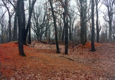
5. Fort Totten Today
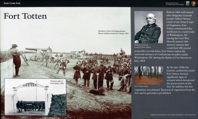
By the late 1920s the historic earthworks inside Fort Totten showed significant signs of erosion which threatened the preservation of the fort. To stabilize the fort vegetation was planted. Removal of vegetation from the fort and its grounds is prohibited.Close-up of photo on marker
Credits. This page was last revised on January 30, 2023. It was originally submitted on March 8, 2016, by Allen C. Browne of Silver Spring, Maryland. This page has been viewed 500 times since then and 12 times this year. Photos: 1, 2, 3, 4, 5, 6. submitted on March 8, 2016, by Allen C. Browne of Silver Spring, Maryland. • Bill Pfingsten was the editor who published this page.
