Los Banos in Merced County, California — The American West (Pacific Coastal)
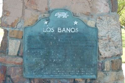
Los Banos
Los Baños (The Baths) del Padre Arroyo was a favorite bathing place for padres from San Juan Bautista Mission during their travels to San Joaquin Valley. Visited as early as 1805 by Spanish explorers, its name was changed to Los Banos Creek by later American emigrants. The town of Los Banos was established at its present site in 1889, after the location of the post office of Los Banos near the creek in 1874.
Erected 1957 by California State Park Commission/Native Sons of the Golden West, Los Banos Parlor No. 206. (Marker Number 550.)
Topics and series. This historical marker is listed in this topic list: Settlements & Settlers. In addition, it is included in the California Historical Landmarks, and the Native Sons/Daughters of the Golden West series lists. A significant historical year for this entry is 1805.
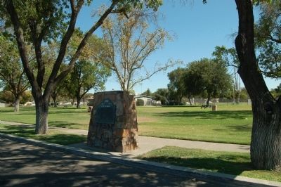
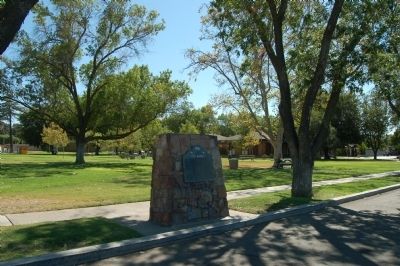
Location. 37° 3.397′ N, 120° 50.773′ W. Marker is in Los Banos, California, in Merced County. Marker is on East Pacheco Boulevard (California Route 33/152) west of 9th Street, on the right when traveling west. Marker is located at Los Banos City Park. Touch for map. Marker is at or near this postal address: 803 East Pacheco Boulevard, Los Banos CA 93635, United States of America. Touch for directions.
Other nearby markers. At least 8 other markers are within 17 miles of this marker, measured as the crow flies. Guglielmo Marconi (approx. 0.3 miles away); Woolgrowers (approx. 0.3 miles away); Henry Miller (approx. 0.4 miles away); Canal Farm Inn (approx. 0.8 miles away); Lone Willow Station (approx. 4.9 miles away); San Luis Camp Adobe (approx. 7.3 miles away); Gustine Museum (approx. 16.2 miles away); Enterprise School (approx. 16.2 miles away). Touch for a list and map of all markers in Los Banos.
Also see . . . Los Banos, California. Wikipedia entry (Submitted on July 14, 2022, by Larry Gertner of New York, New York.)
Credits. This page was last revised on July 14, 2022. It was originally submitted on September 9, 2011, by Barry Swackhamer of Brentwood, California. This page has been viewed 1,214 times since then and 100 times this year. Last updated on March 10, 2016, by James King of San Miguel, California. Photos: 1, 2, 3. submitted on September 9, 2011, by Barry Swackhamer of Brentwood, California. • Bill Pfingsten was the editor who published this page.


