Waterfront in Buffalo in Erie County, New York — The American Northeast (Mid-Atlantic)
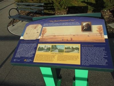
"The Best Planned City"
"The Best Planned City"
Olmsted's Park System concept, to this day, is being replicated in cities around the world as communities are creating greenways woven into the urban fabric and connecting people to parks and the natural environment.
Nation's First Park and Parkway System
Frederick Law Olmsted, who together with his partner Calvert Vaux was known throughout the country for the design of New York's Central Park, arrived in Buffalo in August 1868 at the invitation of local park advocated to propose a park plan. After his visit, Olmsted and Vaux prepared a report recommending that he city adopt their innovative idea of creating three parks, each in a different part of the town, and connecting them by broad, tree-lined avenues they called "parkways." The city accepted their proposal, thus beginning a decades long relationship with Olmsted and his associated, which resulted in the nation's first comprehensively planned municipal park system since listed on the National Register of Historic Places in 1982.
A View Approaching Art
Olmsted carefully selected the sites for each of the parks, capitalizing on the geographic advantages Buffalo had to offer. No location represents this idea better than Front Park (originally called The Front), just up Porter Avenue from this site. Serving as the point of connection between the park and parkway system and the waterfront, Front Park was designed to provide visitors with a commanding view of the broad waters of Lake Erie and their tumbling and whirling passage into the narrow portal of the Niagara River. In the words of Olmsted, the scene at sunset was "a view approaching art."
The Lungs of the City
The 1870 plan laid out the park system in tandem with the radial street plan devised for Buffalo by Joseph Ellicott in 1804. Olmsted admired the original city plan and thought of his own work as complementing that begun by Ellicott. The network of parkways and streets that Olsted and Vaux, and later the Olmsted firm, envisioned for Buffalo connected the parks to eacj other and to the center city. The parkways were also intended to be healthful ribbons of green space in the new residential neighborhoods through which they passed. They would, in effect, become "the lungs of the city." After the completion of Buffalo's park and parkway system in 1876, Olmsted declared Buffalo "the best planned city, as to its streets, public places and grounds in the United States, if not the world."
Erected by Buffalo Olmsted Parks Conservancy, City of Buffalo Division of Parks & Recreation.
Topics. This historical marker is listed in this topic list: Environment. A significant historical month for this entry is August 1868.
Location.
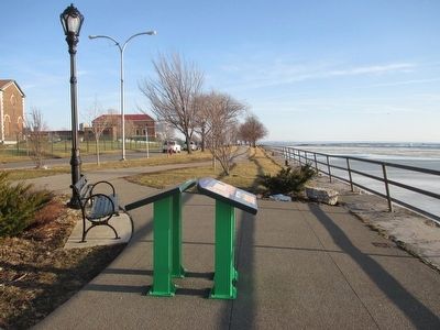
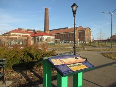
42° 53.787′ N, 78° 54.106′ W. Marker is in Buffalo, New York, in Erie County. It is in Waterfront. Marker can be reached from the intersection of Amvets Drive and Porter Avenue, on the right when traveling south. Marker is at the entrance to La Salle Park at the foot of Porter Avenue. Touch for map. Marker is in this post office area: Buffalo NY 14202, United States of America. Touch for directions.
Other nearby markers. At least 8 other markers are within walking distance of this marker. Waterfront Sites (here, next to this marker); Dedicated with Respect (approx. 0.2 miles away); Oliver Hazard Perry Monument (approx. 0.4 miles away); In Memory of 100th New York Volunteer Infantry (approx. 0.4 miles away); 28th U. S. Infantry (approx. half a mile away); Robert "Frankie" Franklin (approx. 0.6 miles away); American Doughboy "Over the Top" to Victory (approx. 0.6 miles away); St. Mary's-on-the-Hill (approx. 0.7 miles away). Touch for a list and map of all markers in Buffalo.
Also see . . .
1. Frederick Law Olmsted - Wikipedia. (Submitted on March 12, 2016, by Anton Schwarzmueller of Wilson, New York.)
2. Delaware Park - Front Park System. National Register of Historic Places form, National Archives. (Submitted on September 17, 2023, by Anton Schwarzmueller of Wilson, New York.)
Credits. This page was last revised on September 17, 2023. It was originally submitted on March 12, 2016, by Anton Schwarzmueller of Wilson, New York. This page has been viewed 418 times since then and 14 times this year. Photos: 1, 2, 3. submitted on March 12, 2016, by Anton Schwarzmueller of Wilson, New York.


