Zephyrhills in Pasco County, Florida — The American South (South Atlantic)
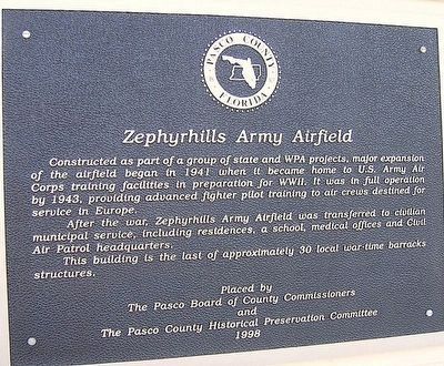
Zephyrhills Army Airfield
After the war, Zephyrhills Army Airfield was transferred to civilian municipal service, including residences, a school, medical offices and Civil Air Patrol headquarters.
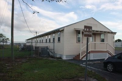
This building is the last of approximately 30 local war-time barracks structures.
Erected 1998 by Pasco County Board of County Commissioners and Pasco County Historical Preservation Committee.
Topics. This historical marker is listed in these topic lists: Air & Space • War, World II.
Location. 28° 13.839′ N, 82° 9.814′ W. Marker is in Zephyrhills, Florida, in Pasco County. Marker is on South Avenue, 0.2 miles east of Airport Road, on the right when traveling east. Marker is located on the wall of the Zephyrhills Airport Barracks Museum of Military History. Touch for map. Marker is at or near this postal address: 39444 South Avenue, Zephyrhills FL 33542, United States of America. Touch for directions.
Other nearby markers. At least 8 other markers are within 2 miles of this marker, measured as the crow flies. A Harsh Green Desert (approx. 0.3 miles away); Zephyrhills Railroad Depot (approx. 0.3 miles away); Aaron W. Guynn (approx. 0.4 miles away); Zephyrhills Depot (approx. 0.4 miles away); Veterans Park (approx. 0.4 miles away); GAR Hall (approx. 1.1 miles away); Veterans Memorial (approx. 1.6 miles away); Oakside Cemetery (approx. 1.6 miles away). Touch for a list and map of all markers in Zephyrhills.
Credits. This page was last revised on April 10, 2018. It was originally submitted on March 12, 2016, by Tim Fillmon of Webster, Florida. This page has been viewed 458 times since then and 34 times this year. Photos: 1, 2, 3, 4, 5. submitted on March 12, 2016, by Tim Fillmon of Webster, Florida. • Bernard Fisher was the editor who published this page.
