Near Geneva in Seminole County, Florida — The American South (South Atlantic)
King Philipstown/Osceola
(side 1)
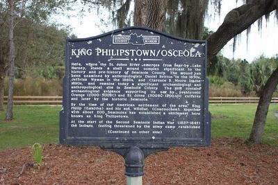
Here, where the St. Johns River emerges from near-by Lake Harney, stands a shell mound complex significant to the history and pre-history of Seminole County. The mound has been examined by anthropologists Daniel Britton in the 1850s, Jeffries Wyman in the 1860s, and Clarence B. Moore in the 1890s, and remains today a significant archaeological and anthropological site in Seminole County. The site contains archaeological evidence supporting its use by prehistoric Orange (2000-500 BC) and St. Johns (500 BC-1500 AD) cultures and later by the historic Seminole.
By the time of the Americans settlement of the area, King Philip (Emaltha) and his son, Wildcat, (Coacoochee), together with about 200 Seminoles has established a settlement here known as King Philipstown.
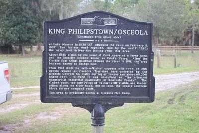
At the start of the Second Seminole Indian War (1837-1842) the Indians, feeling threatened by the army camp established
About 1850 a man by the name of Cook operated a ferry here, and the location became known as Cook's Ferry. After the Florida East Coast Railroad crossed the river in 1911, the area became known as Bridge End. From 1916-1940 the self-sufficient cypress mill town of 200 people known as Osceola flourished here operated by the Osceola Cypress Co. Daily cutting of lumber ran about 60,000 board feet. In 1926 it was described as "the principal commercial industrial community of Seminole County." The timber gone, the only relics of its past still visible are timber piling along the river bank, and on land, the square concrete block former company vault.
The area is presently known as Osceola Fish Camp.
Erected by Seminole County Historical Commission.
Topics. This historical marker is listed in these topic lists: Anthropology & Archaeology • Native Americans • Wars, US Indian.
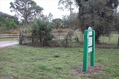
Location. 28° 47.284′ N, 81° 4.067′ W. Marker is near Geneva, Florida, in Seminole County. Marker is on Osceola Fish Camp Road, 0.1 miles east of East Osceola Road, on the right when traveling east. Marker is located at the St Johns Trailhead of the Flagler Trail North and the Lake Harney Wilderness Area. Touch for map. Marker is at or near this postal address: 2195 Osceola Fish Camp Rd, Geneva FL 32732, United States of America. Touch for directions.
Other nearby markers. At least 8 other markers are within 10 miles of this marker, measured as the crow flies. Fort Lane (approx. 3.8 miles away); The First United Methodist Church of Geneva (approx. 4.4 miles away); Veterans Memorial (approx. 4.7 miles away); George C. Means Memorial Bridge (approx. 7 miles away); Heroes of the World War (approx. 7 miles away); Central Florida Cattlemen (approx. 7.6 miles away); Community Builders (approx. 8.9 miles away); Midway/Canaan City (approx. 9.9 miles away). Touch for a list and map of all markers in Geneva.
Regarding King Philipstown/Osceola. The Second Seminole War started in 1835, not 1837 as the marker text states.
Credits. This page was last revised on July 12, 2018. It was originally submitted on March 15, 2016, by Tim Fillmon of Webster, Florida. This page has been viewed 825 times since then and 118 times this year. Photos: 1, 2, 3. submitted on March 15, 2016, by Tim Fillmon of Webster, Florida. • Bernard Fisher was the editor who published this page.


