Near Blanding in San Juan County, Utah — The American Mountains (Southwest)
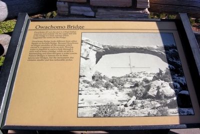
Owachomo Bridge
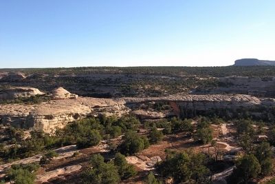
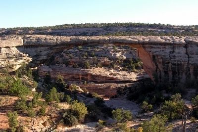
Owachomo Bridge looks different from either Sipapu or Kachina Bridge. Because Owachomo no longer straddles all the streams which carved it, it appears to be an arch. Flowing water is required to carve a hole through a rock wall to form a bridge, while an arch is freestanding and does not span a water course. Natural Bridges if famous for its three spectacular bridges, but the monument also contains smaller and less noticeable arches.
Erected by National Park Service.
Topics. This historical marker is listed in these topic lists: Environment • Native Americans.
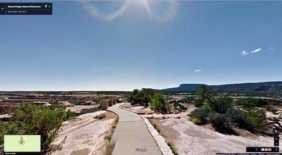
Location. 37° 35.069′ N, 110° 0.819′ W. Marker is near Blanding, Utah, in San Juan County. Marker can be reached from Bridge View Drive, 6.7 miles Visitor Center Parking Lot, on the right when traveling south. Marker is 200 feet south of the bridge parking area. Touch for map. Marker is in this post office area: Lake Powell UT 84533, United States of America. Touch for directions.
Other nearby markers. At least 5 other markers are within 11 miles of this marker, measured as the crow flies. Bears Ears (approx. 1.2 miles away); Kachina Bridge (approx. 1.2 miles away); Sipapu Bridge (approx. 2.1 miles away); Utah's First National Monument (approx. 2.6 miles away); Salvation Knoll (approx. 10.8 miles away).
Also see . . .
1. Natural Bridges National Monument. Official National Park Service website. (Submitted on March 16, 2016.)
2. Owachomo Bridge. National Park Service website page on the bridge. (Submitted on March 16, 2016.)
Credits. This page was last revised on June 16, 2016. It was originally submitted on March 16, 2016, by Duane Hall of Abilene, Texas. This page has been viewed 349 times since then and 7 times this year. Photos: 1, 2, 3, 4. submitted on March 16, 2016, by Duane Hall of Abilene, Texas.


