Lockport in Niagara County, New York — The American Northeast (Mid-Atlantic)
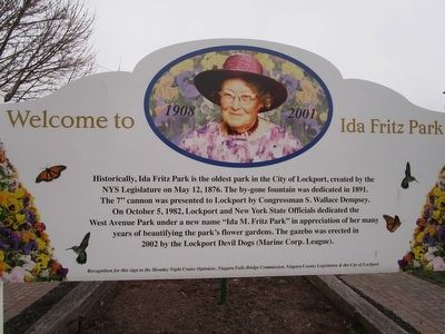
Welcome to Ida Fritz Park
Welcome to Ida Fritz Park
1908 2001
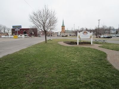
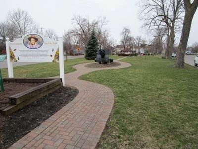
Historically, Ida Fritz Park is the oldest park in the City of Lockport, created by the NYS Legislature on May 12, 1876. The by-gone fountain was dedicated in 1891. The 7" cannon was presented to Lockport by Congressman S. Wallace Dempsey. On October 5, 1892, Lockport and New York State Officials dedicated the West Avenue Park under a new name "Ida Fritz Park" in appreciation of her many years beautifying the park's flower gardens. The gazebo was erected in 2002 by the Lockport Devil Dogs (Marine Corp. League).
Erected by Monday Night Cruise Optimists, Niagara Falls Bridge Commission, Niagara County Legislature & the City of Lockport.
Topics. This historical marker is listed in this topic list: Charity & Public Work. A significant historical date for this entry is May 12, 1876.
Location. 43° 10.123′ N, 78° 41.886′ W. Marker is in Lockport, New York, in Niagara County. Marker is at the intersection of West Avenue and Park Avenue, on the left when traveling east on West Avenue. Touch for map. Marker is in this post office area: Lockport NY 14094, United States of America. Touch for directions.
Other nearby markers. At least 8 other markers are within walking distance of this marker. Lafayette's Tour (about 300 feet away, measured in a direct line); Dole House (about 500 feet away); Niagara County Courthouse (about 600 feet away); W.H. Upson Coal Company Building (about 600 feet away); Lockport Locks (about 800 feet away); Lockport Municipal Building (approx. 0.2 miles away); The “Big Bridge” (approx. 0.2 miles away); Col. W. M. Bond House (approx. 0.2 miles away). Touch for a list and map of all markers in Lockport.
Credits. This page was last revised on June 16, 2016. It was originally submitted on March 23, 2016, by Anton Schwarzmueller of Wilson, New York. This page has been viewed 747 times since then and 35 times this year. Photos: 1, 2, 3. submitted on March 23, 2016, by Anton Schwarzmueller of Wilson, New York.


