The Beaches in Jacksonville Beach in Duval County, Florida — The American South (South Atlantic)
American Red Cross Volunteer Life Saving Corps and Station
Inscription.
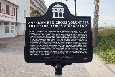
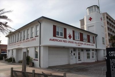
In 1912, following the drowning of a prominent citizen, Dr. Lyman Haskell and Clarence MacDonald established and trained Florida’s first U.S. Volunteer Life Saving Corps (VLSC) at this location to protect the lives of bathers on Jacksonville Beach (then Pablo Beach). On April 17, 1914, the American National Red Cross chartered this unit of lifeguards as its first American Red Cross VLSC in the U.S., and the unit served as a training model for other beaches around Florida. The VLSC celebrated its 100th anniversary of uninterrupted volunteer service at this station in 2012 after recording more than 1,500 life-saving rescues and 1.3 million volunteer hours at the site. Since 1913, three permanent VLSC stations have stood here. The present station, constructed of concrete block and stucco in the Art Moderne style, was designed by architect Jefferson D. Powell and completed in 1948. Among the traditions of the VLSC is the Annual Ocean Marathon Swim, which has been sponsored continuously by the Meninak Club of Jacksonville since 1934.
Erected 2012 by The Meninak Club of Jacksonville and the Florida Department of State. (Marker Number F-758.)
Topics. This historical marker is listed in these topic lists: Charity & Public Work • Landmarks • Waterways & Vessels. A significant historical year for this entry is 1912.
Location. 30° 17.323′ N, 81° 23.329′ W. Marker is in Jacksonville Beach, Florida, in Duval County. It is in The Beaches. Marker is on Beach Boulevard east of 1st Street South, on the left when traveling east. Touch for map. Marker is at or near this postal address: 2 Oceanfront N, Jacksonville Beach FL 32250, United States of America. Touch for directions.
Other nearby markers. At least 8 other markers are within walking distance of this marker. Beaches Museum Chapel (approx. ¼ mile away); Mayport Depot (approx. ¼ mile away); First Settlers At Ruby, Florida (approx. ¼ mile away); Pablo Beach Post Office (approx. ¼ mile away); Steam Locomotive No.7 (approx. ¼ mile away); Porter Wood Burning Locomotive (approx. 0.3 miles away); Doolittle's 1922 Record Flight (approx. 0.3 miles away); Pablo Beach FEC Foreman's House (approx. 0.3 miles away). Touch for a list and map of all markers in Jacksonville Beach.
Credits. This page was last revised on February 3, 2023. It was originally submitted on March 24, 2016, by Tim Fillmon of Webster, Florida. This page has been viewed 474 times since then and 12 times this year. Photos: 1, 2. submitted on March 24, 2016, by Tim Fillmon of Webster, Florida. • Bernard Fisher was the editor who published this page.

