Bayport in Hernando County, Florida — The American South (South Atlantic)
Bayport's Early Historic Period/Post Civil War Era
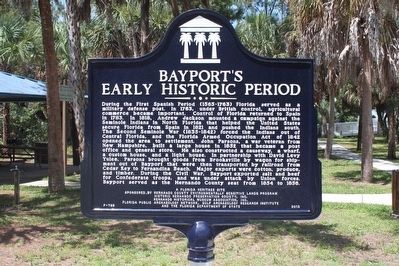
Bayport's Early Historic Period
During the First Spanish Period (1565-1763) Florida served as a military defense port. In 1763, under British control, agricultural commerce became important. Control of Florida returned to Spain in 1783. In 1818, Andrew Jackson mounted a campaign against the Seminole Indians in North Florida that helped the United States secure Florida from Spain in 1821 and pushed the Indians south. The Second Seminole War (1835-1842) forced the Indians out of Central Florida, and the Florida Armed Occupation Act of 1842 opened the area to settlement. John Parsons, a war veteran from New Hampshire, built a large house in 1852 that became a post office and general store. He also constructed a causeway, a wharf, a custom house, and a light house. In partnership with David Levy Yulee, Parsons brought goods from Brooksville by wagon for shipment out of Bayport that were then transported by railroad from Cedar Key to Fernandina Beach. Major exports were cotton, produce, and timber. During the Civil War, Bayport exported salt and beef for Confederate troops, and was under attack by Union forces. Bayport served as the Hernando County seat from 1854 to 1856.
Side 2:
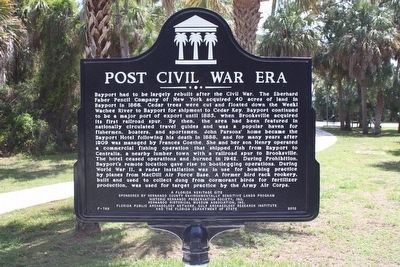
Post Civil War Era
Bayport had to be largely rebuilt after the Civil War. The Eberhard Faber Pencil Company of New York acquired 40 acres of land in Bayport in 1866. Cedar trees were cut and floated down the Weeki Wachee River to Bayport for shipment to Cedar Key. Bayport continued to be a major port of export until 1885, when Brooksville acquired its first railroad spur . By then, the area had been featured in nationally circulated travel guides and was a popular haven for fishermen, boaters, and sportsmen. John Parsons' home became the Bayport Hotel following his death in 1888, and for many years after 1909 was managed by Frances Goethe. She and her son Henry operated a commercial fishing operation that shipped fish from Bayport to Centralia, a nearby lumber town with a railroad spur to Brooksville. The hotel ceased operations and burned in 1942. During Prohibition, Bayport's remote location gave rise to bootlegging operations. During World War II, a radar installation was in use for bombing practice by planes from MacDill Air Force Base. A former bird rack rookery, built and used to collect dung from cormorant birds for fertilizer production, was used for target practice by the Army Air Corps.
Erected 2013 by Hernando County Environmentally Sensitive Lands Program, Historic Hernando Preservation Society, Inc., Hernando Historical Museum Association, Inc., Florida Public Archeology Network, Gulf Archeology Research Institute and the Florida Department of State. (Marker Number F-789.)
Topics. This historical marker is listed in these topic lists: Native Americans • Settlements & Settlers • War, US Civil • War, World II.
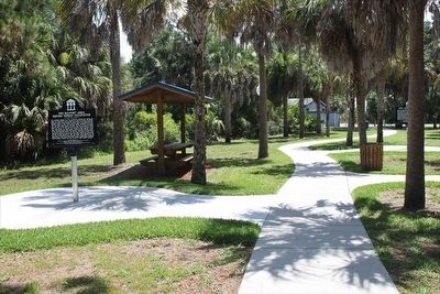
Location. 28° 32.153′ N, 82° 39.067′ W. Marker is in Bayport, Florida, in Hernando County. Marker can be reached from Cortez Boulevard (County Road 550) 6˝ miles west of Commercial Way (U.S. 19), on the right when traveling west. Marker is in the Bayport Park picnic area near the boat ramp parking lot, at the end of Cortez Blvd, west of Weeki Wachee State Park. Touch for map. Marker is at or near this postal address: 4140 Cortez Boulevard, Spring Hill FL 34607, United States of America. Touch for directions.
Other nearby markers. At least 8 other markers are within 13 miles of this marker, measured as the crow flies. The Bayport Area Before Human Occupation/Bayport's First People (a few steps from this marker); Bayport in the Civil War/The Battle of Bayport (within shouting distance of this marker); Bayport (about 600 feet away, measured in a direct line); Aripeka Historic District (approx. 7.2 miles away); Town of Centralia (approx. 8 miles away); Veterans Memorial Flag Pole (approx.
9.1 miles away); Hudson Area Veterans Memorial (approx. 12.1 miles away); Hudson Cemetery (approx. 12.1 miles away). Touch for a list and map of all markers in Bayport.
Related marker. Click here for another marker that is related to this marker.
Credits. This page was last revised on August 6, 2017. It was originally submitted on March 26, 2016, by Tim Fillmon of Webster, Florida. This page has been viewed 570 times since then and 45 times this year. Photos: 1, 2, 3. submitted on March 26, 2016, by Tim Fillmon of Webster, Florida. • Bernard Fisher was the editor who published this page.


