Mound City in Linn County, Kansas — The American Midwest (Upper Plains)
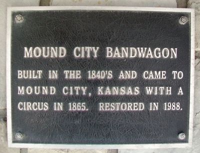
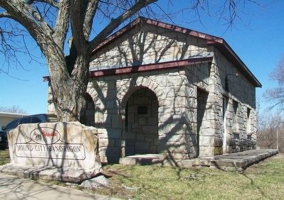
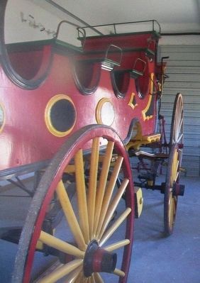
Mound City Bandwagon
Erected by Mound City Historical Society.
Topics. This historical marker is listed in these topic lists: Entertainment • Roads & Vehicles. A significant historical year for this entry is 1865.
Location. 38° 8.567′ N, 94° 49.073′ W. Marker is in Mound City, Kansas, in Linn County. Marker is on Main Street (State Highway 52) west of 7th Street, on the right when traveling west. Touch for map. Marker is at or near this postal address: Mound City Historical Park, Mound City KS 66056, United States of America. Touch for directions.
Other nearby markers. At least 8 other markers are within walking distance of this marker. Fort Montgomery (here, next to this marker); Log Corncrib (a few steps from this marker); Windmill and Water Trough (a few steps from this marker); Clausen Cabin (a few steps from this marker); Wesley Chapel Bell (a few steps from this marker); Barn (within shouting distance of this marker); Number 9 School (within shouting distance of this marker); Warzel Bungalow (within shouting distance of this marker). Touch for a list and map of all markers in Mound City.
Credits. This page was last revised on September 6, 2020. It was originally submitted on March 28, 2016, by William Fischer, Jr. of Scranton, Pennsylvania. This page has been viewed 310 times since then and 16 times this year. Photos: 1, 2, 3. submitted on March 28, 2016, by William Fischer, Jr. of Scranton, Pennsylvania.


