Guatemala City in Guatemala Department, — Central America
The Mirador Canal
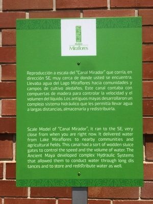
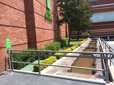
Scale Model of "Canal Mirador", it ran to the SE, very close from when you are right now. It delivered water from Lake Miraflores to nearby communities and agricultural fields. This canal had a sort of wodden sluice gates to control the speed and the volume of water. The Ancient Maya developed complex Hydraulic Systems that allowed them to conduct water through long distances and to store and redistribute water as well.
Erected by Museo Miraflores.
Topics. This historical marker is listed in these topic lists: Agriculture • Anthropology & Archaeology • Man-Made Features • Native Americans.
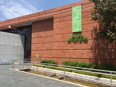
Location. 14° 37.222′ N, 90° 33.26′ W. Marker is in Guatemala City, Guatemala (Guatemala Department). Marker can be reached from 7a Calle. The marker is directly to the right of the entrance to the Museo Miraflores in Guatemala City. Touch for map. Marker is at or near this postal address: 7a Calle 21-55, Zona 11, Guatemala City, Guatemala 01011, Guatemala. Touch for directions.
Other nearby markers. At least 8 other markers are within 5 kilometers of this marker, measured as the crow flies. Monuments in La Palangana (approx. 1.4 kilometers away); La Palangana Building Complex (approx. 1.4 kilometers away); The Acropolis at Kaminaljuyú (approx. 1.5 kilometers away); Ceremonial Area (approx. 1.5 kilometers away); Tomb of Justo Rufino Barrios (approx. 3 kilometers away); Jorge Toriello Garrido (approx. 3 kilometers away); 300th Anniversary of the Founding of the San Carlos University of Guatemala (approx. 3.6 kilometers away); Dr. Carlos Martínez Durán (approx. 3.6 kilometers away). Touch for a list and map of all markers in Guatemala City.
Regarding The Mirador Canal. The Miraflores Museum opened in 2002 as a way to protect some of the last temple mounds of the Kaminaljuyu Mayan site in the midst of an area of
rapid urban development. The museum contains close to 2,000 pieces related to Mayan history.
Credits. This page was last revised on June 26, 2019. It was originally submitted on March 29, 2016, by J. Makali Bruton of Accra, Ghana. This page has been viewed 303 times since then and 7 times this year. Photos: 1, 2, 3, 4. submitted on March 29, 2016, by J. Makali Bruton of Accra, Ghana.


