New Hartford in Litchfield County, Connecticut — The American Northeast (New England)
Satanís Kingdom
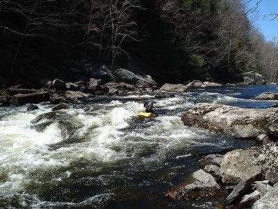
Farmington River: Wild & Scenic
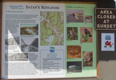
This beautiful river gorge, with its towering cliffs, has been called Satanís Kingdom since at least the 1820s. The origin of the name has been the subject of much debate; one story involves a Native American tribe leader nicknamed “Satan”. In the mid 1800s, Satanís Kingdom was a settlement populated by people who adopted an Indian lifestyle. This area was inhabited by Native Americans and many of societyís outcasts such as outlaws and ex-slaves; this is another possible reason for the name.
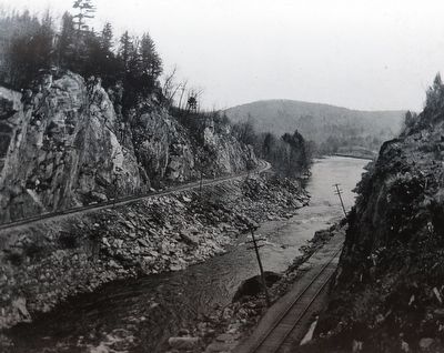
In the 1870ís, trains of the Central New England Railroad (CNE) operated throughout the rugged hills of the northwest corner of Connecticut. CNE trains originated in Hartford and traveled northwest to Tariffville and East Granby and then headed south through Simsbury, Canton, and Collinsville before heading north and entering the rugged gorge. The railroad tracks continued westbound paralleling the old Albany Turnpike (currently Route 44), until they reached Millerton which is on the Connecticut/New York border. The New Haven & Northampton Railroad (the Canal Line) tracks ran on the west side of Satanís Kingdom. This branch of the railroad, completed in 1850, ran from Plainville to New Hartford. Remains of the railroad tracks and bridges can still be found on both sides of the river downstream of the Route 44 Bridge.
back
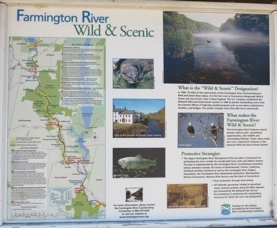
What is the “Wild & Scenic” Designation?
In 1994, 14 miles of the west branch of the Farmington River received National Wild and Scenic River status. It is the first river in Connecticut designated Wild & Scenic and one of just a few in New England. The U.S. Congress established the National Wild and Scenic Rivers System in 1968 to protect outstanding rivers from the harmful effects of federally-assisted projects such as new dams, hydroelectric facilities, and bridges. The system includes more than 200 rivers nationwide.
What makes the Farmington River Wild & Scenic ?
The Farmington River features natural beauty, historic sites, recreational opportunities, rare wildlife and outstanding fisheries. These values make the river a natural for inclusion in the National Wild and Scenic Rivers System.
Erected by Farmington River Coordinating Committee.
Topics. This historical marker is listed in these topic lists: Environment • Native Americans • Settlements & Settlers • Waterways & Vessels. A significant historical year for this entry is 1820.
Location. 41° 51.54′ N, 72° 57.536′ W. Marker is in New Hartford, Connecticut, in Litchfield County. Marker is on U.S. 44, on the right when traveling north. Touch for map. Marker is at or near this postal address: 107 Main St, New Hartford 06057, New Hartford CT 06057, United States of America. Touch for directions.
Other nearby markers. At least 8 other markers are within 4 miles of this marker, measured as the crow flies. Liberty Tree Memorial (approx. 1.2 miles away); New Hartford (approx. 1.2 miles away); New Hartford Remembers (approx. 1.8 miles away); New Hartford Soldiers Memorial (approx. 1.8 miles away); First Meeting House (approx. 2.1 miles away); Constitution Oak (approx. 3Ĺ miles away); In Memory of Phoebe Humphrey (approx. 3Ĺ miles away); Collinsville, Town of Canton (approx. 3Ĺ miles away). Touch for a list and map of all markers in New Hartford.
Also see . . . Satanís Kingdom. (Submitted on April 12, 2016, by Alan M. Perrie of Unionville, Connecticut.)
Credits. This page was last revised on November 11, 2020. It was originally submitted on April 12, 2016, by Alan M. Perrie of Unionville, Connecticut. This page has been viewed 1,892 times since then and 91 times this year. Photos: 1, 2, 3, 4. submitted on April 12, 2016, by Alan M. Perrie of Unionville, Connecticut. 5. submitted on April 17, 2016, by Alan M. Perrie of Unionville, Connecticut. • Bill Pfingsten was the editor who published this page.
