La Paz Centro, León, Nicaragua — Central America
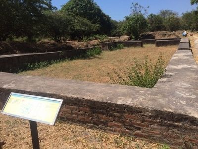
"Unidentified" Colonial Structure No 11
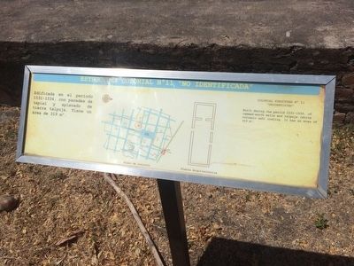
Estructura Colonial No 11 "No Identificada"
Inscription.
Edificada en el periodo 1531-1534, con paredes de tapial y aplanado de tierra talpuja. Tiene un área de 319 m2.
Caption: Plano de conjunto
Plano Arquitectónica
English:
Colonial Structure No 11
"Unidentified"
Built during the period 1531-1534, of rammed-earth walls and talpuja (white volcanic ash) coating. It has a area of 319 m2.
Captions: Site map
Floor plan
Topics. This historical marker is listed in these topic lists: Anthropology & Archaeology • Colonial Era • Hispanic Americans • Man-Made Features.
Location. 12° 24.059′ N, 86° 37.07′ W. Marker is in La Paz Centro, León. The marker is at León Viejo Archaeological Site, south of the Central Park. Touch for map. Touch for directions.
Other nearby markers. At least 8 other markers are within walking distance of this marker. "The Royal Road" (within shouting distance of this marker); “The Town Council” (about 90 meters away, measured in a direct line); "The Town Square" (about 90 meters away); “The House of Ana Jiménez” (about 120 meters away); “The Saint Mary of Graces Cathedral” (about 120 meters away); “The Palace of Governor Rodrigo de Contreras” (about 180 meters away); "The House of Hernando de Soto and Hernán Ponce de León" (about 210 meters away); "The House of Martín" (about 210 meters away). Touch for a list and map of all markers in La Paz Centro.
Credits. This page was last revised on June 16, 2016. It was originally submitted on April 15, 2016, by J. Makali Bruton of Accra, Ghana. This page has been viewed 266 times since then and 5 times this year. Photos: 1, 2. submitted on April 15, 2016, by J. Makali Bruton of Accra, Ghana.

