Kanesville Crossing: A Rush For Gold
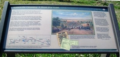
Some 10,000 goldseekers ferried the Missouri River at Council Bluffs in 1849. The settlement was "only a little Burg between two high bluffs," but over the next two decades it became the preferred "jumping off" point for thousands of overland emigrants bound for the Pacific Coast.
The Mormon town of Kanesville dominated the area until 1853, when Council Bluffs came into its own as a rambunctious border town. Wagons and livestock jammed the narrow, dusty streets. "Such profanity I never knew existed!" complained Harriet Ward.
Upper, middle, and lower ferries—crossing the river to today's Florence, downtown Omaha, and South Omaha—charged whatever the traffic would bear. In high water, steamboats and later specialized steam ferries helped emigrants get their wagons across "Old Muddy's" dangerous waters.
The 1869 transcontinental railroad insured the city's enduring importance to American travel and commerce when it crossed the Missouri at Council Bluffs.
[Illustration description]
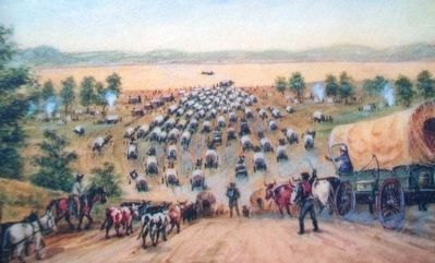
In the 1930's, frontier artist and photographer William Henry Jackson produced a series of paintings based on sketches and memories of scenes he witnessed as a "bullwhacker" on the California Trail in 1866. This image of the Kanesville Crossing depicts the crush of wagons waiting to ferry the muddy Missouri.
"Started at
daylight for the ferry...the banks were lined with those that staid there last night. We have a promise of the ferry for today but there are companies that have laid here 48 hours have a like promise...considerable quarrelling as to who shall have the boats.... Indians are plenty around the ferry on both sides of the river."—Byron McKinstry, 1850
"Made the necessary preparations to go aboard the ferry. But we still had some time to wait, and this gave us a chance to look over the town—an easy matter, as it consisted only of a couple of huts, a saloon, and a gambling house.... We crossed the river without mishap. The current was rather swift, and the ferry had to go up the river a considerable distance to make sure of landing at the right place on the opposite bank."
—Tosten Kittelsen Stabaek, 1852
"Proceeded on to the river. There were over one hundred waggons waiting to cross ahead of ours, but by cunning management we got aboard of the steamer Hindoo, and were ferried over before our turn. Passage $4 a waggon and 30˘ a head for stock."
—William Richard Brown, 1853
"This town is an old French and Indian trading station at the base of a very prominent bluff.... Here were about 1,000 wagons waiting to equip and cross the river. There is only one ferry boat and it with only the capacity to cross about fifty
—Harriet A. Loughary, 1864
The "Handy Traveler" recommended 363 items to make up a "complete outfit" for a wagon trip to the Pacific. The cost in year 2000 dollars would be "$12,269.03.
[Map description]
The California Trail followed the natural highway of the Platte and Sweetwater Rivers to the Continental Divide and diverged into a variety of alternates until it reached the Humboldt River and the Sierra Nevada.
Erected by National Park Service and the Pottawattamie County Historic Trails Association.
Topics. This historical marker is listed in these topic lists: Roads & Vehicles • Settlements & Settlers • Waterways & Vessels. A significant historical year for this entry is 1849.
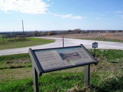
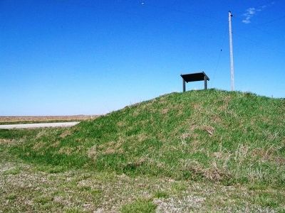
Location. 41° 11.772′ N, 95° 44.303′ W. Marker is near Council Bluffs, Iowa, in Pottawattamie County. Marker is at the intersection of Pioneer Trail and Dumfries Avenue, on the right when traveling east on Pioneer Trail. Marker is on a small hill on the southeast side of the intersection. Touch for map. Marker is in this post office area: Council Bluffs IA 51503, United States of America. Touch for directions.
Other nearby markers. At least 8 other markers are within 8 miles of this marker, measured as the crow flies. Hyde Park (approx. 1.4 miles away); Mormon Battalion Mustering Grounds (approx. 4.8 miles away); "Freedom With Honor" (approx. 6.9 miles away);
Also see . . .
1. California National Historic Trail. (Submitted on April 17, 2016, by William Fischer, Jr. of Scranton, Pennsylvania.)
2. Across Iowa in '49. (Submitted on April 17, 2016, by William Fischer, Jr. of Scranton, Pennsylvania.)
Credits. This page was last revised on June 16, 2016. It was originally submitted on April 16, 2016, by William Fischer, Jr. of Scranton, Pennsylvania. This page has been viewed 475 times since then and 65 times this year. Photos: 1, 2, 3, 4. submitted on April 17, 2016, by William Fischer, Jr. of Scranton, Pennsylvania.


