Near Easleyville in St. Helena Parish, Louisiana — The American South (West South Central)
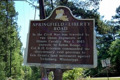
Springfield - Liberty Road
Topics. This historical marker is listed in these topic lists: Roads & Vehicles • War, US Civil. A significant historical date for this entry is May 1, 1863.
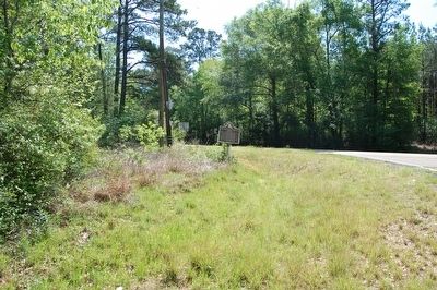
Location. 30° 55.863′ N, 90° 40.17′ W. Marker is near Easleyville, Louisiana, in St. Helena Parish. Marker is at the intersection of State Highway 38 and State Highway 441, on the left when traveling east on State Highway 38. Touch for map. Marker is in this post office area: Kentwood LA 70444, United States of America. Touch for directions.
Other nearby markers. At least 8 other markers are within 10 miles of this marker, measured as the crow flies. Republic of West Florida (approx. 6.3 miles away); William Kendrick Square (approx. 7 miles away); Revolutionary War Memorial (approx. 7.1 miles away); Greensburg Land Office (approx. 7.1 miles away); Greater Greensburg Veteran's War Memorial (approx. 7.1 miles away); Camp Moore (approx. 9.9 miles away); Camp Moore Confederate Cemetery (approx. 9.9 miles away); Camp Moore #6 (approx. 9.9 miles away).
Also see . . . Grierson's Raid. Wikipedia (Submitted on April 13, 2016.)
Credits. This page was last revised on August 14, 2022. It was originally submitted on April 12, 2016. This page has been viewed 634 times since then and 40 times this year. Last updated on April 28, 2016. Photos: 1, 2. submitted on April 12, 2016. • Bernard Fisher was the editor who published this page.

