Near Jones Creek in Brazoria County, Texas — The American South (West South Central)
Ellerslie Plantation
Inscription.
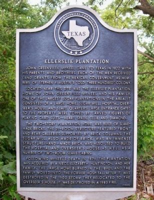
John Greenville McNeel came to Texas in 1822 with his parents and brothers. Each of the men received land grants from the Mexican government as members of Stephen F. Austin's "Old Three Hundred" colony.
Located near this site was the Ellerslie Plantation, home of John Greenville McNeel and his family. One of the largest sugar plantations in the area, it consisted of a large home, sugar mill, hospital, overseer's house, and slave quarters. Large entrance gates to the property were topped by carved figures of playing card suits-- heart, spade, club, and diamond.
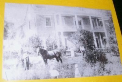
The two-story plantation home was built of slave-made bricks. The 21-room structure featured front and rear galleries supported by brick columns. The sugar mill, also made of brick, was an immense structure. Hand-made brick was also used to build the hospital and overseer's house, as well as a number of two-room slave cabins.
Following McNeel's death in 1876, the plantation was acquired by a niece, Elizabeth Huntington, and her family. The large home burned in the 1890s, and the family moved into the former hospital. After it was destroyed in the 1900 storm they relocated to the overseer's house. It was destroyed in a 1983 fire. (1989)
Erected 1989 by Texas Historical Commission. (Marker Number 9558.)
Topics. This historical marker is listed in these topic lists: African Americans • Settlements & Settlers • War, US Civil. A significant historical year for this entry is 1822.
Location. 28° 59.092′ N, 95° 30.292′ W. Marker is near Jones Creek, Texas, in Brazoria County. Marker is at the intersection of Weldon Road and State Highway 36, on the right when traveling east on Weldon Road. Touch for map. Marker is in this post office area: Freeport TX 77541, United States of America. Touch for directions.
Other nearby markers. At least 8 other markers are within 2 miles of this marker, measured as the crow flies. Old Oakland (within shouting distance of this marker); Major Reuben R. Brown (approx. 2 miles away); William Joel Bryan (approx. 2 miles away); General Stephen Fuller Austin (approx. 2 miles away); Emily Margaret Brown Austin Bryan Perry (approx. 2 miles away); James Franklin Perry (approx. 2 miles away); Henry William Munson (approx. 2 miles away); Major James Peckham Caldwell (approx. 2 miles away). Touch for a list and map of all markers in Jones Creek.
More about this marker. This location is better known as McNeel's Plantation near the town of Jones Creek.
Regarding Ellerslie Plantation. Not mentioned

Photographed By Texmexfla, July 21, 2008
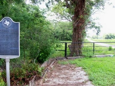
2. Ellerslie Plantation Marker and View of Farmland
Plenty of Texas Confederate units visited here to obtain food and forage. Confederate Major General John Bankhead Magruder used this plantation as his headquarters for a time. During the Civil War this was known as McNeel's Plantation.

Photographed By Texmexfla, August 15, 2008
3. McNeel Plantation Photo
This is a photo of a 1800’s photo on display at the Brazoria Chamber of Commerce on West Smith Street in Brazoria, Texas. Unfortunately taking a photo of a copy of photo that is behind glass makes the picture not a clear as desired.

Photographed By Texmexfla, August 15, 2008
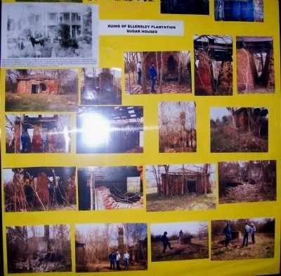
4. Sugar House Ruins
This photo was taken at a display in the Brazoria Chamber of Commerce. Ruins of the sugar production facility from the 1800's are pictured. Due to the important sugar production this plantation was a place sought by Union troops during the War Between The States (1861-5). Sugar, Cotton, and Beef are still a major source of income in the county.
Credits. This page was last revised on July 31, 2016. It was originally submitted on July 22, 2008, by Texmexfla of Houston, Texas. This page has been viewed 5,980 times since then and 46 times this year. Photos: 1, 2. submitted on July 22, 2008, by Texmexfla of Houston, Texas. 3, 4. submitted on August 16, 2008, by Texmexfla of Houston, Texas. • Craig Swain was the editor who published this page.
