Richmond in Contra Costa County, California — The American West (Pacific Coastal)
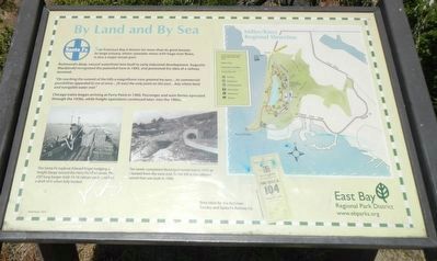
By Land and By Sea

Photographed By Barry Swackhamer, May 19, 2016
1. By Land and By Sea Marker
Captions: (left) The Santa Fe tugboat Edward Engel nudging a freight barge toward the Ferry Point wharves. The 250' long barges held 14-16 railcars each and had a draft of 6' when fully loaded.; (center) The newly completed Municipal tunnel in 1915 as it looked from the west end. To the left is the railroad tunnel that was built in 1900.; (right) Map of Miller/Knox Regional Shoreline & Time table for the Atchison, Topeka, and Santa Fe Railway Co.
Richmond's deep natural waterfront lent itself to early industrial development. Augustin Macdonald recognized the potential here in 1895, and promoted the idea of a railway terminal.
"On reaching the summit of the hills a magnificent view greeted my eyes...its commercial possibilities appealed to me a once...(it was) the only point on the east...bay where land and navigable water met."
Chicago trains began arriving at Ferry Point in 1900. Passengers and auto ferries operated through the 1930s, while freight operations continued later, into the 1960s.
Erected by East Bay Regional Park District.
Topics. This historical marker is listed in these topic lists: Railroads & Streetcars • Waterways & Vessels.
Location. 37° 55.255′ N, 122° 23.15′ W. Marker is in Richmond, California, in Contra Costa County. Marker is on Doran Drive near Western Drive, on the right when traveling south. Touch for map. Marker is at or near this postal address: 783 Doran Drive, Richmond CA 94801, United States of America. Touch for directions.
Other nearby markers. At least 8 other markers are within walking distance of this marker. First City Hall of Richmond (approx. 0.4 miles away); Bank of Richmond (approx. 0.4 miles away); The Critchett Hotel (approx. 0.4 miles away); The Richmond Supply Company Building (approx. 0.4 miles away); Women's Westside Improvement Club (approx. 0.4 miles away); "The Sentinel" (approx. 0.4 miles away); Our Lady of Mercy Church (approx. 0.4 miles away); El Toro (approx. 0.6 miles away). Touch for a list and map of all markers in Richmond.
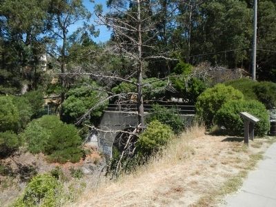
More about this marker. This marker is located in Miller/Knox Regional Shoreline near automobile tunnel.
Credits. This page was last revised on June 16, 2016. It was originally submitted on May 21, 2016, by Barry Swackhamer of Brentwood, California. This page has been viewed 370 times since then and 20 times this year. Photos: 1, 2. submitted on May 21, 2016, by Barry Swackhamer of Brentwood, California.
