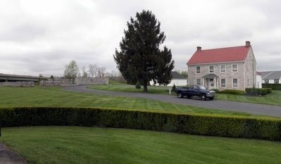
Near Camp Hill in Cumberland County, Pennsylvania — The American Northeast (Mid-Atlantic)
Sporting Hill
Sunday, June 28, 1863
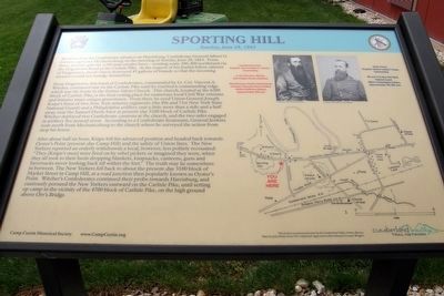
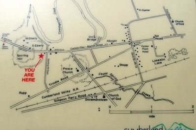
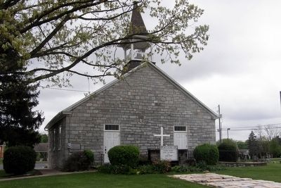
From Hodgestown, this band of Confederates, led by Lt. Col. Vincent A. Witcher, continued east on the Carlisle Pike until he reached a commanding ridge which was the home to the former Salem Church. The church, located on the 6200 block of Carlisle Pike, is the final resting place for numerous Civil War veterans and features many unique gravestones. From there he eyed Union General Joseph Knipe’s force of two New York infantry regiments (the 8th and 71st New York State National Guard) and a Philadelphia artillery unit a little more than a mile and a half away, near the Samuel Eberly barn at present-day 5100 block of Carlisle Pike. Witcher deployed two Confederate cannons at the church, and the two sides engaged in artillery fire around noon. According to a Confederate lieutenant, General Jenkins rode north to the church from Mechanicsburg to the church where he surveyed the action from atop his horse.
After about half an hour, Knipe left his advanced position and headed back towards Oyster’s Point (present day Camp Hill) and the safety of the Union lines. The New Yorkers reported an orderly withdrawal; a local, however, less politely recounted: “They [Knipe’s men] were fired on by rebel pickets or imagined they were, when they took to their heels dropping blankets, knapsacks, canteens, guns and haversacks never looking back till within the fort.” The truth may lie somewhere in between. The New Yorkers fell back to about the present-day 3100 block of Market Street in Camp Hill, at a road junction then popularly known as Oyster’s Point. Witcher’s Confederates continued their probe towards Harrisburg, and cautiously pursued the New Yorkers eastward on the Carlisle Pike, until setting up camp in the vicinity of the 4700 block of Carlisle Pike, on the high ground above Orr’s Bridge.
Erected 2015 by Camp Curtin Historical Society.
Topics. This historical marker is listed in this topic list: War, US Civil. A significant historical date for this entry is June 28, 1863.
Location. 40° 14.154′ N, 76° 58.498′ W. Marker is near Camp Hill, Pennsylvania, in Cumberland County. Marker is on Hampden Park Drive, 0.2 miles west of South Sporting Hill Road, on the right when traveling
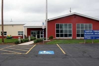
west. Near the main entrance to the Hampden Township Recreation Center. Touch for map. Marker is at or near this postal address: 5001 Hampden Park Dr, Mechanicsburg PA 17050, United States of America. Touch for directions.
Other nearby markers. At least 8 other markers are within 2 miles of this marker, measured as the crow flies. A different marker also named Sporting Hill (here, next to this marker); Gettysburg Campaign (approx. 0.2 miles away); Peace Church (approx. 0.7 miles away); a different marker also named Gettysburg Campaign (approx. 0.8 miles away); a different marker also named Peace Church (approx. 1.1 miles away); George Croghan (approx. 1.2 miles away); Samuel Albright House (approx. 1.7 miles away); Silver Spring Presbyterian Church (approx. 1.7 miles away). Touch for a list and map of all markers in Camp Hill.
Also see . . .
1. Camp Curtin Historical Society and Civil War Roundtable. (Submitted on May 24, 2016.)
2. Skirmish of Sporting Hill. Wikipedia entry. (Submitted on April 14, 2020, by Larry Gertner of New York, New York.)
Credits. This page was last revised on April 15, 2020. It was originally submitted on May 24, 2016, by Larry Gertner of New York, New York. This page has been viewed 903 times since then and 26 times this year. Photos: 1, 2, 3, 4, 5. submitted on May 24, 2016, by Larry Gertner of New York, New York. • Bernard Fisher was the editor who published this page.
