Ticonderoga in Essex County, New York — The American Northeast (Mid-Atlantic)
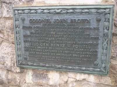
Colonel John Brown
killed October 19th, 1780 at Stone Arabia, N.Y. on his thirty-fifth birthday.
Was with Ethan Allen, May 10th, 1775.
Made a gallant attempt to retake the fort
September 17th to 22nd, 1777
but failed owing to the sturdy defence of
Brig. Gen. Henry W. Powell
Colonel Brown destroyed the shipping and outer works, captured 225 British and Germans and released 100 American prisoners.
Erected 1935 by Massachusetts Society of the Colonial Dames of America.
Topics and series. This historical marker is listed in these topic lists: Forts and Castles • War, US Revolutionary. In addition, it is included in the The Colonial Dames of America, National Society of series list. A significant historical date for this entry is May 10, 1809.
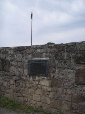
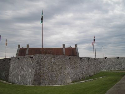
Location. 43° 50.484′ N, 73° 23.288′ W. Marker is in Ticonderoga, New York, in Essex County. Marker can be reached from Sandy Redoubt, on the right when traveling east. Marker is on the south wall near the entrance of Fort Ticonderoga. Touch for map. Marker is in this post office area: Ticonderoga NY 12883, United States of America. Touch for directions.
Other nearby markers. At least 8 other markers are within walking distance of this marker. Fort Carillon (a few steps from this marker); Split 13-inch Mortar (a few steps from this marker); 150th Anniversary of the Capture of This Fort (within shouting distance of this marker); Through this entrance . . . (within shouting distance of this marker); 200th Anniversary of Washington’s Inspection (within shouting distance of this marker); Colonel Ethan Allen (within shouting distance of this marker); History of Fort Ticonderoga (within shouting distance of this marker); Gen. Henry Knox Trail (within shouting distance of this marker). Touch for a list and map of all markers in Ticonderoga.
Also see . . .
1. Fort Ticonderoga National Historic Landmark. (Submitted on July 23, 2008, by Bill Coughlin of Woodland Park, New Jersey.)
2. The Capture of Fort Ticonderoga. History website entry (Submitted on June 6, 2021, by Larry Gertner of New York, New York.)
Credits. This page was last revised on June 6, 2021. It was originally submitted on July 23, 2008, by Bill Coughlin of Woodland Park, New Jersey. This page has been viewed 1,757 times since then and 23 times this year. Photos: 1, 2, 3, 4. submitted on July 23, 2008, by Bill Coughlin of Woodland Park, New Jersey.


