Near Enoree in Spartanburg County, South Carolina — The American South (South Atlantic)
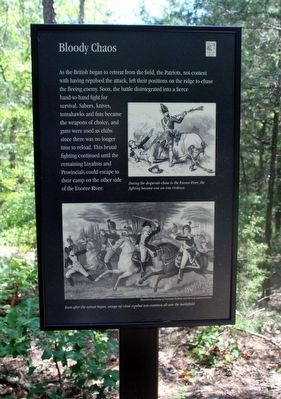
Bloody Chaos
Erected by South Carolina State Park Service.
Topics. This historical marker is listed in this topic list: War, US Revolutionary. A significant historical date for this entry is August 19, 1780.
Location. 34° 36.084′ N, 81° 51.068′ W. Marker is near Enoree, South Carolina, in Spartanburg County. Marker can be reached from Horseshoe Falls Road (State Highway S-42-10) 1.4 miles south of State Highway 56, on the left when traveling south. This marker is one of a series along the Musgrove Mill Battlefield Trail. The trail starts at a parking area and leads to a loop where the main battle action occurred. This marker is in the loop section approximately 5400 feet from the start of the trail. Touch for map. Marker is in this post office area: Enoree SC 29335, United States of America. Touch for directions.
Other nearby markers. At least 8 other markers are within walking distance of this marker. The Main Event (within shouting distance of this marker); The Enemy Within (within shouting distance of this marker); Ready for the Enemy (within shouting distance of this marker); Captain Shadrach Inman Memorial (within shouting distance of this marker); The Trap Is Sprung (about 400 feet away, measured in a direct line); Winning the Battle & the War (about 500 feet away); In Hot Pursuit (about 700 feet away); A Bad Situation Gets Worse (approx. 0.2 miles away). Touch for a list and map of all markers in Enoree.
More about this marker. This part of the trail is in forest having re-entered from a clearing where the main battle action occurred.
Regarding Bloody Chaos. Illustration at right: "During the desperate chase to the Enoree River, the fighting became one-on-one violence."
Illustration at bottom: "Soon after the retreat began, savage up-close combat was common all over the battlefield." – Illustration courtesy of National Archives and Records Administration
Additional keywords. Musgrove's Mill
Credits. This page was last revised on June 16, 2016. It was originally submitted on June 5, 2016, by David Graff of Halifax, Nova Scotia. This page has been viewed 437 times since then and 22 times this year. Photo 1. submitted on June 5, 2016, by David Graff of Halifax, Nova Scotia. • Bernard Fisher was the editor who published this page.
