San Lorenzo, San Vicente, El Salvador — Central America (West Coast)
The Cuscatlán Bridge
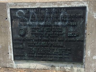
Puente Cuscatlan
Señor Presidente de la Republica
Dr. Armando Calderon Sol 1994-1999
Ministro de Obras Públicas
Arq. Roberto Bará Osequeda
Viceministro de Obras Públicas
Ing. Wilfredo Rosales
Longitud del puente: 398.7 m Ancho: 17.7 m Carga HS-25
Ejecutor: Ministerio de Obras Públicas, Unidad Coordinadora de Proyectos
Consultor: Nippon Koei Co., Ltd., Tokyo, Japan en asociación con NHA Compañía de Ingenieros, S.A. El Salvador, Louis Berger International Inc., Washington D.C., USA, Katahira & Engineers International, Tokyo, Japan
Contratista: Rizzani de Eccher S.p.A. & C.C.C. S.p.A., Udine, Italia.
Mayo 1999
Constructed in the period of the most excellent
President of the Republic
Dr. Armando Calderón Sol 1994-1999
Government officials, consultants and contractors involved in the construction
Length: 398.7 m Width: 17.7 m Load HS-025
May 1999
Erected 1999.
Topics. This historical marker is listed in this topic list: Bridges & Viaducts. A significant historical month for this entry is May 1999.
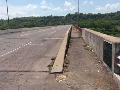
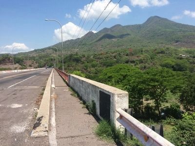
Location. 13° 36.646′ N, 88° 34.119′ W. Marker is in San Lorenzo, San Vicente. Marker is on Carretera Panamericana, on the right when traveling east. The marker is on the western end of the bridge before crossing the Lempa River. Touch for map. Touch for directions.
Other nearby markers. At least 5 other markers are within 26 kilometers of this marker, measured as the crow flies. House Where Alberto Masferrer Was Born (approx. 14.4 kilometers away in Usulután); Doctor Manuel Enrique Araujo (approx. 14.4 kilometers away in Usulután); Roberto Edmundo Canessa (approx. 18.1 kilometers away in Usulután); Field Marshal Santiago González (approx. 18.1 kilometers away in Usulután); San Marcos Lempa Bridge (approx. 25.1 kilometers away in Usulután).
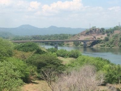
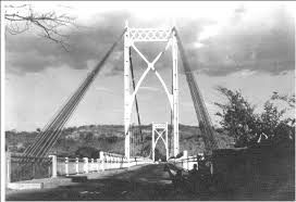
Regarding The Cuscatlán Bridge. This bridge over the River Lempa is one of two bridges over the river that divides El Salvador into western and eastern halves. This bridge dedicated in 1999 replaces a bridge built in the 1940s by the Roebling's Sons Company. The previous bridge was destroyed by Farabundo Marti Liberation National (FMLN) forces, using over a ton of explosives, on December 31, 1983.
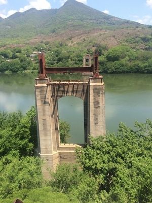
Photographed By J. Makali Bruton, May 21, 2016
5. Foundations of the original Cuscatlán Bridge
These concrete foundations of the original Cuscatlán Bridge are upriver from the new bridge location. They are about one kilometer east of the new bridge, to the left onto the abandoned portion of the Panamerican Highway.
Credits. This page was last revised on September 13, 2018. It was originally submitted on June 5, 2016, by J. Makali Bruton of Accra, Ghana. This page has been viewed 729 times since then and 55 times this year. Photos: 1, 2, 3, 4, 5, 6. submitted on June 5, 2016, by J. Makali Bruton of Accra, Ghana.
