Near Monticello in San Juan County, Utah — The American Mountains (Southwest)
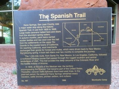
The Spanish Trail
The 1,120-mile route, from Santa Fe, New Mexico; to Los Angeles, California, followed a northward looping course that passed through the rugged southern and central landscapes of Utah. This trail avoided the deep canyons of the Colorado River and the hostile Indians of Arizona.
In 1848, at the end of the Mexican war, the territory encompassing the Spanish Trail became part of the United States. Thereafter, caravan traffic followed direct east-west lines. In the post-trail period, the waters of Kane Springs refreshed weary travelers, cattle drovers, pioneer settlers, and outlaws.
Erected 1996 by Monticello Camp, Daughters of Utah Pioneers. (Marker Number 487.)
Topics and series. This historical marker is listed in these topic lists: Exploration • Roads & Vehicles. In addition, it is included in the Daughters of Utah Pioneers series list. A significant historical year for this entry is 1829.
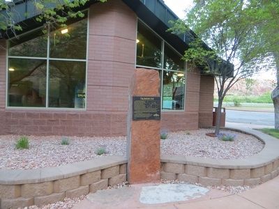
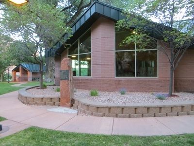
Location. 38° 23.611′ N, 109° 27.141′ W. Marker is near Monticello, Utah, in San Juan County. Marker can be reached from U.S. 191 at milepost 110.4, on the right when traveling north. Marker is in the Kane Springs rest area. Touch for map. Marker is in this post office area: Monticello UT 84535, United States of America. Touch for directions.
Other nearby markers. At least 8 other markers are within 14 miles of this marker, measured as the crow flies. Hole N” The Rock, Utah (approx. ¼ mile away); Wilson Arch (approx. 9.4 miles away); Historic La Sal Post Office (approx. 12.3 miles away); Star Hall (approx. 13½ miles away); Star Hall History (approx. 13½ miles away); The Old Log Cabin (approx. 13½ miles away); Moab L.D.S. Church (approx. 13½ miles away); Early L.D.S. Church (approx. 13½ miles away). Touch for a list and map of all markers in Monticello.
More about this marker. Kane Springs is closer to Moab than Monticello, but Kane Springs is in the Monticello zip code area.
Credits. This page was last revised on June 16, 2016. It was originally submitted on June 8, 2016, by Bill Kirchner of Tucson, Arizona. This page has been viewed 401 times since then and 18 times this year. Photos: 1, 2, 3. submitted on June 8, 2016, by Bill Kirchner of Tucson, Arizona.


