Cheyenne in Laramie County, Wyoming — The American West (Mountains)
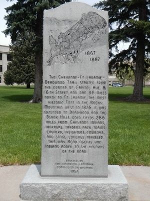
The Cheyenne - Ft. Laramie - Deadwood Trail
1867 - 1887
Inscription.
Erected 1957 by Historical Marker Commission of Wyoming.
Topics. This historical marker is listed in this topic list: Roads & Vehicles.
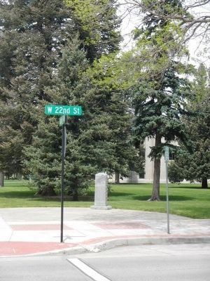
Location. 41° 8.29′ N, 104° 49.124′ W. Marker is in Cheyenne, Wyoming, in Laramie County. Marker is on Capitol Avenue near West 22nd Street, on the right when traveling north. Touch for map. Marker is at or near this postal address: 199 Capitol Avenue, Cheyenne WY 82001, United States of America. Touch for directions.
Other nearby markers. At least 8 other markers are within walking distance of this marker. Site of Cheyenne's Carnegie Public Library -- 1901-1966 (within shouting distance of this marker); Mrs. Esther Hobart Morris (about 600 feet away, measured in a direct line); Elling William "Bill" Golling (about 700 feet away); Wyoming Army and Air National Guard Memorial (about 800 feet away); Wyoming Spanish American War Monument (about 800 feet away); Esther Hobart Morris (approx. 0.2 miles away); Dedicated to You, A Free Citizen in a Free Land (approx. 0.2 miles away); Mt. Sinai Congregation (approx. 0.2 miles away). Touch for a list and map of all markers in Cheyenne.
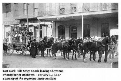
Also see . . . Cheyenne-Deadwood Stage - Wyoming Tales and Trails. Although not as significant as the Overland Stage, probably no stage line has attracted more attention than the Deadwood Stage, more properly, the Cheyenne and Blackhills Stage and Express Line. The fame of the line and of Deadwood itself, was assured by being early featured in Edward L. Wheeler's Deadwood Dick series of half-dime novels and Col. Cody's Wild West show. (Submitted on June 18, 2016, by Barry Swackhamer of Brentwood, California.)
Credits. This page was last revised on June 18, 2016. It was originally submitted on June 18, 2016, by Barry Swackhamer of Brentwood, California. This page has been viewed 500 times since then and 12 times this year. Photos: 1, 2, 3. submitted on June 18, 2016, by Barry Swackhamer of Brentwood, California.


