Fredericksburg, Virginia — The American South (Mid-Atlantic)
A Diversion: Second Battle of Fredericksburg
Inscription.
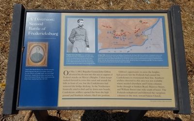
On May 3, 1863, Brigadier General John Gibbon advanced his division into this area in support of Federal attacks on Marye’s Heights. Union troops rushed forward to cross this canal and assault the hills in front of you, but the Confederates had removed the bridge decking. As the Northerners frantically tried to find and lay down new boards, Confederate artillery opened fire from the high ground and Southern infantry filed into position.
Gibbon’s opportunity to seize the heights had passed, but the Federals had caused the Confederates to overextend their line. Southern artillery directed to this area was not available where needed elsewhere and Union columns broke through at Sunken Road, Hanover Street, and William Street (one mile south of here). The Federals redeployed and followed the victorious columns to the west, toward Salem Church.
(sidebar)
Captain Oliver Wendell Holmes of the 20th Massachusetts Infantry Regiment took part in his brigade’s advance to the canal. While his unit sought shelter near Fall Hill Road (behind you), shrapnel from an artillery round took off his heel, his third wound of the war. Holmes would serve on the United States Supreme Court from 1902-1932.
(captions)
Brigadier General John Gibbon was a solid fighter from the Regular Army. Born in Philadelphia, but raised in North Carolina, he remained loyal to the Union while his three brothers took up arms for the Confederacy. After the war, in 1876, Gibbon would lead the column that buried George Armstrong Custer and his troopers at the Little Big Horn River.
On May 3, 1863, while the main armies were fighting at Chancellorsville, the Federal Sixth Corps confronted a Confederate division in the second battle of Fredericksburg. That morning, Gibbon maneuvered his force to cross this canal (1), but the Confederates responded by repositioning cannons from William Street (2) and from Fall Hill (3). A Federal assault punched through the weakened Confederate line at William Street (4), while additional columns overran Marye's Heights (5) with the help of an enveloping assault (6). This map is oriented to the direction you are facing and also shows the modern road network.
Erected by Fredericksburg Economic Development and Tourism Office.
Topics. This historical marker is listed in this topic list: War, US Civil. A significant historical date for this entry is May 3, 1863.
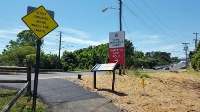
Location. 38° 18.69′ N, 77° 28.61′ W. Marker is in Fredericksburg, Virginia. Marker is on Jefferson Davis Highway (U.S. 1) 0.2
miles south of Fall Hill Avenue (Virginia Route 639), on the right when traveling south. Located along the Rappahannock Canal Path. Touch for map. Marker is in this post office area: Fredericksburg VA 22401, United States of America. Touch for directions.
Other nearby markers. At least 8 other markers are within walking distance of this marker. “Fall Hill” (approx. 0.2 miles away); a different marker also named “Fall Hill” (approx. 0.2 miles away); Elmhurst (approx. 0.3 miles away); Industrial Interlude (approx. 0.4 miles away); The Canal Ditch: Battlefield Obstacle (approx. 0.4 miles away); Carl's (approx. 0.4 miles away); Fredericksburg Granite (approx. half a mile away); Beta Gamma Sigma (approx. half a mile away). Touch for a list and map of all markers in Fredericksburg.
Related marker. Click here for another marker that is related to this marker. Old Marker At This Location titled "A Diversion".
Credits. This page was last revised on February 2, 2023. It was originally submitted on June 20, 2016, by Bernard Fisher of Richmond, Virginia. This page has been viewed 532 times since then and 27 times this year. Photos: 1, 2. submitted on June 20, 2016, by Bernard Fisher of Richmond, Virginia.

