Fredericksburg, Virginia — The American South (Mid-Atlantic)
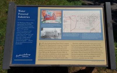
Water Powered Industries
Fredericksburg: Timeless.
In 1855, the Fredericksburg Water Power Company adapted the Rappahannock Company’s navigation canal to be an industrial power canal. The canal turning basin became a mill pond and several raceways soon branched off to power the Germania Flour Mill and the Washington Woolen Mills. In 1887, a local firm established an electric generating plant on Fredericksburg’s lower canal, which introduced electricity to the Rappahannock valley.
Electricity rapidly became the main power source for the area’s industrial enterprises. In 1901, the City of Fredericksburg established a municipal power plant on a raceway fed by this upper canal. In 1910, the Fredericksburg Water Power Company constructed the Embrey Dam to increase the potential horsepower flowing through this canal. The enhanced raceway fed into a new hydro-electric power plant, which remained in operation into the 1960s.
(sidebar)
The Washington Woolen Mills opened before the Civil War and operated into the twentieth century. A newspaper article from May 8, 1922 reported:
“The business today has a trade territory embracing the entire United States and requiring a staff of 26 travelling men…. An office force of 20 is steadily employed…. About 400 mill employees are carried on the payroll…. The firm does an annual business of around $2,000,000.”
(captions)
A fire in 1875 caused significant damage and also cooked off a previously undiscovered Civil War shell. The mill owners quickly rebuilt an expanded plant and resumed operations.
This Civil War photo shows the Woolen Mills in use as a hospital, sheltering wounded Union soldiers from the 1864 battles of the Wilderness and Spotsylvania Court House.
This 1878 map shows the extensive Woolen Mills complex. The inset includes both the upper and lower canals and also shows a portion of this upper canal’s flow being diverted to mills in downtown Fredericksburg. This third canal never materialized because it was superseded by electrical power, beginning in the 1880s.
Erected by Fredericksburg Economic Development and Tourism Office.
Topics and series. This historical marker is listed in these topic lists: Industry & Commerce • Man-Made Features • War, US Civil • Waterways & Vessels. In addition, it is included in the Virginia, Fredericksburg: Timeless. series list.
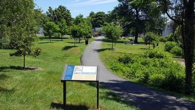
Location. 38° 18.636′ N, 77° 27.996′ W. Marker is in Fredericksburg, Virginia. Marker can be reached from the intersection of Charles Street and Pelham Street, on the left when traveling south. Located along the Rappahannock Canal Path. Touch for map. Marker is in this post office area: Fredericksburg VA 22401, United States of America. Touch for directions.
Other nearby markers. At least 8 other markers are within walking distance of this marker. Rappahannock River Heritage Trail (about 300 feet away, measured in a direct line); Hydroelectricity Brings Changes to Fredericksburg (about 700 feet away); Germania Mill: Recovering from the Civil War (about 700 feet away); A Walking Tour of Fredericksburg’s Historic Old Mill District (about 700 feet away); A Canal Defines Its Neighborhood (about 800 feet away); Walker-Grant High School Class of 1950 Stages Graduation Protest at Fredericksburg Community Center (approx. 0.2 miles away); French John's Wharf (approx. 0.2 miles away); Elmhurst (approx. ¼ mile away). Touch for a list and map of all markers in Fredericksburg.
Credits. This page was last revised on February 2, 2023. It was originally submitted on June 20, 2016, by Bernard Fisher of Richmond, Virginia. This page has been viewed 324 times since then and 13 times this year. Photos: 1, 2. submitted on June 20, 2016, by Bernard Fisher of Richmond, Virginia.

