Fredericksburg, Virginia — The American South (Mid-Atlantic)
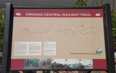
Virginia Central Railway Trail
Along the VCR
In 1853, a group of investors incorporated and began to grade a railway route from Fredericksburg to Orange Court House, 37 miles to the west. In Orange, this new railway would connect with a rail line to Gordonsville, Charlottesville, and Lynchburg. By the time of the Civil War, the Fredericksburg & Gordonsville Railroad Company had graded 18 miles of the right-of-way, but had not yet laid any tracks. During the Civil War, the cleared, level railbed proved tactically useful for rapidly moving troops across an otherwise rough landscape. The railway crosses three battlefields, at Fredericksburg, Chancellorsville, and the Wilderness.
Following the Civil War, the South struggled to rebuild its wrecked economy and work eventually resumed on the unfinished railway. By 1873, workers were laying tracks on the previously prepared route and the first train arrived at the Orange station in 1877. By then, new owners of the railway had renamed it the Potomac, Fredericksburg & Piedmont Railroad Company. The tracks were narrow gauge.
The narrow gauge tracks carried trains until 1926, when the Virginia Central Railway acquired and altered them to a standard gauge. This effort to remain competitive did not pay off, though. In 1931, the company abandoned its track to Orange, retaining only one mile of rails near Fredericksburg, which linked 15 industrial customers with the main line Richmond, Fredericksburg & Potomac Railroad. Even this one mile of railway proved difficult to maintain and it too shut down in 1984.
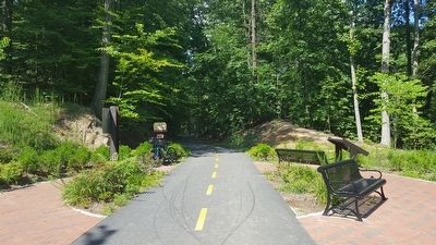
This bicycle/foot trail opened in 2014 and extends nearly three miles to the Idlewood neighborhood. The sounds of train whistles and struggling armies are gone, but historic bridge piers and remnants of Confederate encampments are still visible in the quiet woods.
Captions:
1. This 1884 photograph shows the rail yard in downtown Fredericksburg. The view is looking west.
2. The railway cut is visible on the left side of the photo. The houses on the right are still evident along Lafayette Boulevard. The embankment on the left has been replaced by a residential complex called Cobblestone Square.
3. Virginia Central Railway engine No. 1022.
4. The railway had to cross numerous streams and the original stone abutments were later encased in concrete.
5. The railway company pulled up and sold its tracks after it abandoned the link to Orange Court House. The depressions from the wooden ties are still visible in the foreground.
Erected by Virginia Central Railway Trail.
Topics. This historical marker is listed in these topic lists: Industry & Commerce • Railroads & Streetcars • War, US Civil.
Location. 38° 16.798′ N, 77° 29.971′ W. Marker is in Fredericksburg, Virginia. Marker can be reached from the intersection of Jefferson Davis Highway (U.S. 1) and Kings Mill Drive, on the right when traveling south. Located along the Virginia Central Railway Trail. Touch for map. Marker is at or near this postal address: 4811 Carriage Way Ln, Fredericksburg VA 22401, United States of America. Touch for directions.
Other nearby markers. At least 8 other markers are within 2 miles of this marker, measured as the crow flies. The Railway, With Tracks and Without (about 700 feet away, measured in a direct line); Reestablishing a Travel Way (approx. 0.3 miles away); The Walker Landram House (approx. 0.6 miles away); Fredericksburg (approx. 0.9 miles away); Building a Railroad Through a Stream Valley (approx. one mile away); The Virginia Central Railway (approx. 1.1 miles away); Lee’s Position (approx. 1.1 miles away); Lee’s Hill (approx. 1.3 miles away). Touch for a list and map of all markers in Fredericksburg.
Credits. This page was last revised on February 20, 2023. It was originally submitted on June 20, 2016, by Bernard Fisher of Richmond, Virginia. This page has been viewed 522 times since then and 17 times this year. Photos: 1, 2. submitted on June 20, 2016, by Bernard Fisher of Richmond, Virginia.

