Johns Island in Charleston County, South Carolina — The American South (South Atlantic)
The Progressive Club
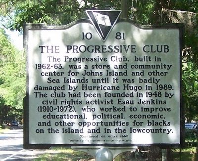
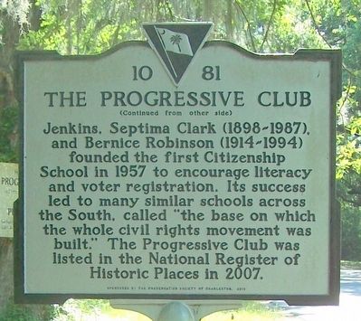
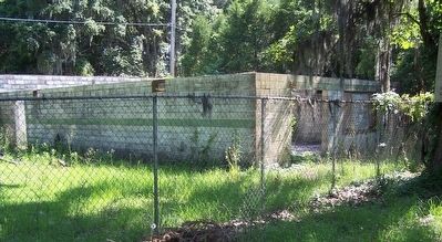
The Progressive Club, built in 1962-63, was a store and community center for Johns Island and other Sea Islands until it was badly damaged by Hurricane Hugo in 1989. The club had been founded in 1948 by civil rights activist Esau Jenkins (1910-1972), who worked to improve educational, political, economic, and other opportunities for blacks on the island and in the lowcountry.
Erected 2013 by Preservation Society of Charleston. (Marker Number 10-81.)
Topics. This historical marker is listed in these topic lists: African Americans • Civil Rights.
Location. 32° 40.622′ N, 80° 2.417′ W. Marker is on Johns Island, South Carolina, in Charleston County. Marker is at the intersection of River Road (State Highway S-10-91) and Royal Oak Drive, on the right when traveling east on River Road. Touch for map. Marker is in this post office area: Johns Island SC 29455, United States of America. Touch for directions.
Other nearby markers. At least 8 other markers are within 6 miles of this marker, measured as the crow flies. John's Island Presbyterian Church (approx. 2˝ miles away); Federal Expedition on John's Island / Battle of Burden's Causeway (approx. 3.1 miles away); Battle of Sol-Legare Island (approx. 4.3 miles away); Mosquito Beach (approx. 4.7 miles away); Hunter's Volunteers (approx. 4.9 miles away); Battery Number 5 (approx. 5˝ miles away); Secessionville (approx. 5.8 miles away); Battle of Secessionville (approx. 5.8 miles away). Touch for a list and map of all markers in Johns Island.
Credits. This page was last revised on April 21, 2023. It was originally submitted on June 20, 2016, by David J Gaines of Pinson, Alabama. This page has been viewed 397 times since then and 17 times this year. Photos: 1, 2, 3. submitted on June 20, 2016, by David J Gaines of Pinson, Alabama. • Bernard Fisher was the editor who published this page.


