Midtown in Ypsilanti in Washtenaw County, Michigan — The American Midwest (Great Lakes)
Ypsilanti Water Tower
Side 1
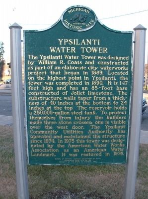
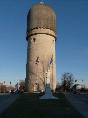
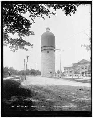
The Ypsilanti Water Tower was designed by William R. Coats and constructed as part of an elaborate city waterworks project that began in 1889. Located on the highest point in Ypsilanti, the tower was completed in 1890. It is 147 feet high and has an 85-foot base constructed of Joliet limestone. The substructure walls taper at the bottom to 24 inches at the top. The reservoir holds a 250,000-gallon steel tank. To protect themselves from injury the builders made three stone crosses; one is visible over the west door. The Ypsilanti Community Utilities Authority has operated and maintained the structure since 1974. In 1975 this tower was designated by the American Water Works Association as an American Water Landmark. It was restored in 1976.
Side 2
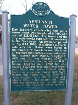
Day laborers constructed this water tower which was completed in 1890 at a cost of $21,435.63. The tower and the city waterworks supplied 471 customers in the first year. An ordinance passed on April 14, 1898, established a yearly rate schedule. Rates were based on the number of faucets in use, the type of business that customers operated and the livestock they owned. A residence with one tap was charged $5.00; a private bathtub cost an extra $2.00. Saloon keepers paid $7.00 for one faucet, $3.00 for each additional faucet and $1.00 for each billiard table. Each cow a person owned cost $1.00. People who failed to pay their bill were subject to a $50.00 fine and ninety days in the county jail. Until 1956 this structure was the only water tower in the Ypsilanti water system.
Erected 1989 by Bureau of History, Michigan Department of State. (Marker Number L1591.)
Topics and series. This historical marker is listed in these topic lists: Architecture • Industry & Commerce. In addition, it is included in the Michigan Historical Commission series list. A significant historical year for this entry is 1890.
Location. 42° 14.727′ N, 83° 37.478′ W. Marker is in Ypsilanti, Michigan, in Washtenaw County. It is in Midtown. Marker is at the intersection of State Highway 17 and North Summit Street, on the left when traveling east on State Highway 17. Touch for map. Marker is at or near this postal address: North Summit Street, Ypsilanti MI 48197, United States of America. Touch for directions.
Other nearby markers. At least 8 other markers are within walking distance of this marker. Eastern Michigan College (about 600 feet away, measured in a direct line); Town Hall School (approx. ¼ mile away); Reverend John D. Pierce (approx. ¼ mile away); 100 Years of Free Public Education (approx. half a mile away); Ypsilanti High School World War Memorial (approx. half a mile away); First Presbyterian Church (approx. half a mile away); First Methodist Episcopal Church (approx. half a mile away); Ladies' Literary Club House (approx. half a mile away). Touch for a list and map of all markers in Ypsilanti.
Also see . . . The Story Behind Ypsilanti’s Iconic Water Tower. (Submitted on June 22, 2016, by Joel Seewald of Madison Heights, Michigan.)
Credits. This page was last revised on February 12, 2023. It was originally submitted on June 22, 2016, by Joel Seewald of Madison Heights, Michigan. This page has been viewed 606 times since then and 63 times this year. Photos: 1, 2, 3, 4. submitted on June 22, 2016, by Joel Seewald of Madison Heights, Michigan.


