Sandy Springs in Fulton County, Georgia — The American South (South Atlantic)
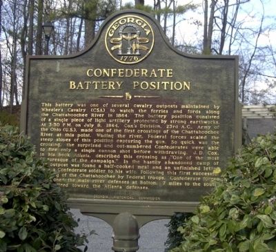
Confederate Battery Position
This battery was one of several cavalry outposts maintained by Wheeler's Cavalry (CS) to watch the ferries and fords along the Chattahoochee River in 1864. The battery position consisted of a single piece of light artillery protected by strong earthworks. At 3:30 P.M. on July 8, 1864, Cox's Division, 23rd A.C., Army of the Ohio (US), made one of the first crossings of the Chattahoochee river at this point. Wading the river, Federal forces scaled the steep slopes of this position capturing the gun. So quick was the crossing, the surprised and out-numbered Confederates were able to fire only a single cannon shot before withdrawing. J.D. Cox, in his book Atlanta, described this crossing as 'One of the most picturesque of the campaign.' In the hastily abandoned camp of the outpost was found a half-cooked meal and an unfinished letter from a Confederate soldier to his wife. Following this first successful crossing of the Chattahoochee by Federal troops, Confederate forces abandoned the main river defenses at Bolton, 7 miles to the south and retired toward the Atlanta defenses.
Erected 1971 by Georgia Historical Commission. (Marker Number 060-196.)
Topics and series. This historical marker is listed in this topic list: War, US Civil. In addition, it is included in the Georgia Historical Society series list. A significant historical date for this entry is July 8, 1864.
Location. 33° 55.362′ N, 84° 25.689′ W. Marker is in Sandy Springs, Georgia, in Fulton County. Marker is on River Chase Point, 0.1 miles west of River Chase Circle, in the median. The marker is in the cul-de-sac at the end of River Chase Point, off River Chase Circle off Heards Ferry Road in Sandy Springs. Touch for map. Marker is at or near this postal address: 660 River Chase Point, Atlanta GA 30328, United States of America. Touch for directions.
Other nearby markers. At least 8 other markers are within 2 miles of this marker, measured as the crow flies. Isom's Ferry (approx. 0.4 miles away); Soap Creek Paper Mills (approx. 1.4 miles away); The 23d Corps at Soap Creek (approx. 1.4 miles away); 4th & 23d A.C. Advance (approx. 1.4 miles away); The 23D Corps at Soap Creek (approx. 1.4 miles away); Howard's 4th A.C. Line (approx. 1.7 miles away); The River Patrol & Cochran’s Ford (approx. 1.7 miles away); Power's Ferry (approx. 1.7 miles away). Touch for a list and map of all markers in Sandy Springs.
Credits. This page was last revised on February 8, 2023. It was originally submitted on July 26, 2008, by David Seibert of Sandy Springs, Georgia. This page has been viewed 1,679 times since then and 12 times this year. Photos: 1, 2, 3. submitted on July 26, 2008, by David Seibert of Sandy Springs, Georgia. • Craig Swain was the editor who published this page.


