Walker Army Air Field
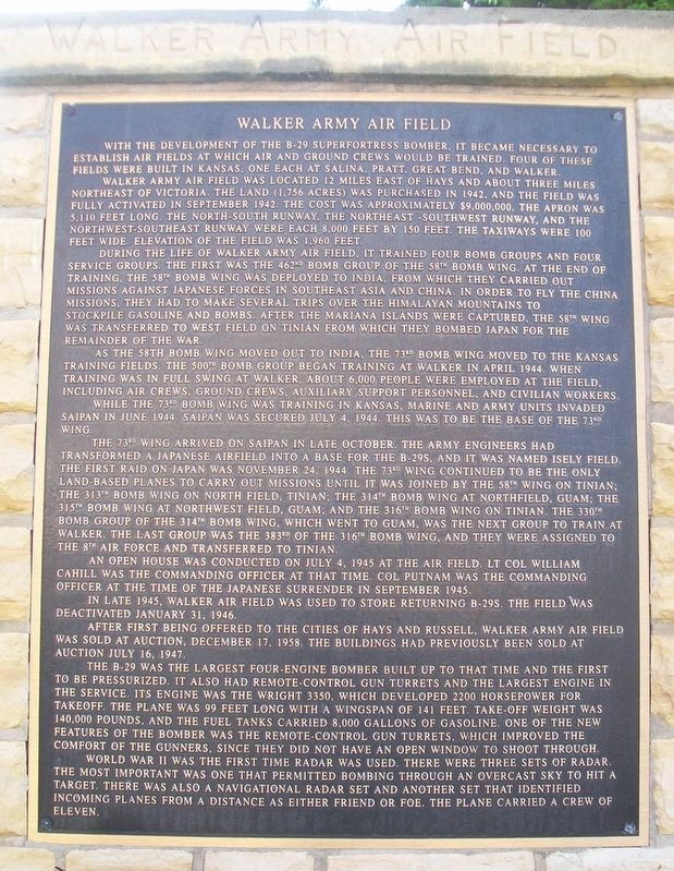
With the development of the B-29 Superfortress bomber, it became necessary to establish air fields at which air and ground crews would be trained. Four of these fields were built in Kansas, one each at Salina, Pratt, Great Bend, and Walker.
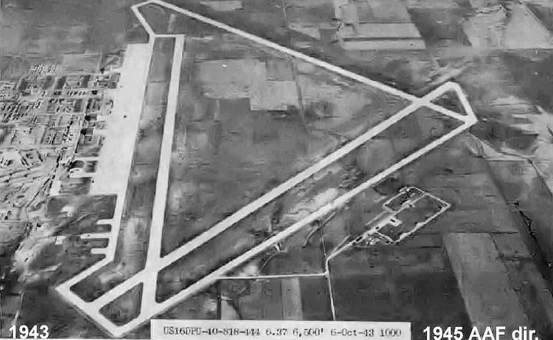
Walker Army Air Field was located 12 miles east of Hays and about three miles northeast of Victoria. The land (1,756 acres) was purchased in 1942, and the field was fully activated in September 1942. The cost was approximately $9,000,000. The apron was 5,110 feet long. The North-South runway, the Northeast-Southwest runway, and the Northwest-Southeast runway were each 8,000 feet by 150 feet. The taxiways were 100 feet wide. Elevation of the field was 1,960 feet.
During the life of Walker Army Air Field, it trained four bomb groups and four service groups. The first was the 462nd Bomb Group of the 58th Bomb Wing. At the end of training, the 58th Bomb Wing was deployed to India, from which they carried out missions against Japanese forces in Southeast Asia and China. In order to fly the China missions, they had to make several trips over the Himalayan mountains to stockpile gasoline and bombs. After the Mariana Islands were captured, the 58th Wing was transferred to West Field on Tinian from which they bombed Japan for the remainder of the war.
As the 58th Bomb Wing moved out to India,
the 73rd Bomb Wing moved to the Kansas training fields. The 500th Bomb Group began training at Walker in April 1944. When training was in full swing at Walker, about 6,000 people were employed at the field, including air crews, ground crews, auxiliary support personnel, and civilian workers.While the 73rd Bomb Wing was training in Kansas, Marine and Army units invaded Saipan in June 1944. Saipan was secured July 4, 1944. This was to be the base of the 73rd Wing.
The 73rd Wing arrived on Saipan in late October. The Army engineers had transformed a Japanese airfield into a base for the B-29s, and it was named Isely Field. The first raid on Japan was November 24, 1944. The 73rd Wing continued to be the only land-based planes to carry out missions until it was joined by the 58th Wing on Tinian; the 313th Bomb Wing on North Field, Tinian; the 314th Bomb Wing at North Field, Guam; the 315th Bomb Wing at Northwest Field, Guam; and the 316th Bomb Wing on Tinian. The 330th Bomb Group of the 314th Bomb Wing, which went to Guam, was the next group to train at Walker. The last group was the 383rd of the 316th Bomb Wing, and they were assigned to the 8th Air Force and transferred to Tinian.
An open house was conducted on July 4, 1945 at the air field. Lt Col William Cahill was the commanding officer at that time. Col Putnam was the commanding officer at the time of the Japanese
In late 1945, Walker Air Field was used to store returning B-29s. The field was deactivated January 31, 1946.
After first being offered to the cities of Hays and Russell, Walker Army Air Field was sold at auction, December 17, 1958. The buildings has previously been sold at auction July 16, 1947.
The B-29 was the largest four-engine bomber built up to that time and the first to be pressurized. It also had remote-control gun turrets and the largest engine in the service. Its engine was the Wright 3350, which developed 2200 horsepower for takeoff. The plane was 99 feet long with a wingspan of 141 feet. Take-off weight was 140,000 pounds, and the fuel tanks carried 8,000 gallons of gasoline. One of the new features of the bomber was the remote-control gun turrets, which improved the comfort of the gunners, since they did not have an open window to shoot through.
World War II was the first time radar was used. There were three sets of radar. The most important was one that permitted bombing through an overcast sky to hit a target. There was also a navigational radar set and another set that identified incoming planes from a distance as either friend or foe. The plane carried a crew of eleven.
Topics. This historical marker is listed in these topic lists: Air & Space • War, World II. A significant historical month for this entry is September 1942.
Location.
Other nearby markers. At least 8 other markers are within walking distance of this marker. Replica of the Statue of Liberty (a few steps from this marker); Col. Wm. F. "Buffalo Bill" Cody (within shouting distance of this marker); Veterans Memorial (about 400 feet away, measured in a direct line); The Volga Germans (about 500 feet away); Gospel Hill (about 600 feet away); Town & County Jail (about 600 feet away); “Dog” Kelley’s Faro House (about 700 feet away); The Pioneer Store (about 700 feet away). Touch for a list and map of all markers in Hays.
Also see . . .
1. Walker Army Airfield mentioned in Kansas Historical Quarterly (Spring 1959). (Submitted on July 4, 2016, by William Fischer, Jr. of Scranton, Pennsylvania.)
2. How It Works: B-29 WWII Bomber on YouTube. (Submitted on July 4, 2016, by William Fischer, Jr. of Scranton, Pennsylvania.)
Credits. This page was last revised on September 2, 2020. It was originally submitted on July 4, 2016, by William Fischer, Jr. of Scranton, Pennsylvania. This page has been viewed 721 times since then and 63 times this year. Photos: 1, 2, 3. submitted on July 4, 2016, by William Fischer, Jr. of Scranton, Pennsylvania.


