Hancock in Washington County, Maryland — The American Northeast (Mid-Atlantic)
Hancock
A Canal Town Community
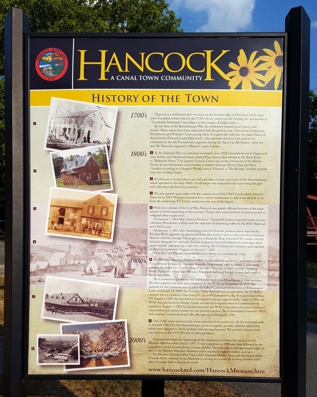
ó History of the Town ó
1700ís
Hancock is a settlement that was once on the frontier edge of Maryland. Early maps show European settlers here in the 1730s. As an outpost on the frontier, the area known as “Tonoloway Settlement” was subject to the ravages of Indian raids.
By the time of the Revolutionary War, the settlement boasted some twenty odd houses. Many names have been associated with the general area—Tonoloway Settlement, Northbend, and William's Town among them. It is generally held that the name Hancock derived from Edward Joseph Hancock Jr., who operated the ferry here prior to his enlistment in the 8th Pennsylvania regiment during the American Revolution. After the war Mr. Hancock migrated to Wayne County, Indiana.
1800ís
1 As the National Pike was extended westward (circa 1818) the town boomed. Stagecoach inns, liveries, and blacksmith shops dotted Main Street, then known as the Bank Road or “Baltimore Street.” Our present Visitor's Center sits on the former site of the Barton House, an inn that hosted such notables as Andrew Jackson, Henry Clay, and Davy Crockett, according to a Harper's Weekly article. Pictured, is “The Brooke,” another popular stop over on Main Street.
2 A toll house is located about one half mile west of town and is one of the few remaining which operated in the early 1800's. A toll keeper was responsible for supervising the gate and collecting tolls from this structure.
3 The next growth spurt came with the construction of the C&O Canal, which reached Hancock by 1839. Wharves extended from various warehouses to take trade directly to or from the canal boats. PT. Little's warehouse was one of the largest.
4 With the outbreak of the Civil War, Hancock was greatly affected because of the main arteries of travel transecting at this junction. Troops were stationed here at various points to safeguard these supply lines.
On January 1, 1862 Maj. General Thomas J. "Stonewall" Jackson marched north in bitter cold from Winchester to Bath with the objective of disturbing traffic on the B&O Railroad and C&O Canal.
On January 4, 1862, after skirmishing with the Federals, Jackson's force reached the Potomac River opposite our garrisoned town. His artillery fired on the town from Orricks Hill but did little damage. Union garrison commander Brig. General F.W. Lander refused Jackson's demands for surrender. Jackson continued the bombardment for two days while unsuccessfully searching for a safe river crossing. The Confederates withdrew and marched on Romney, in western Virginia, on January 7, 1862.
After the Civil War, the

via Maryland Department of Natural Resources, unknown
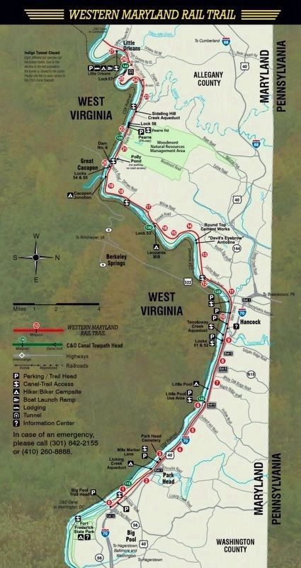
2. Western Maryland Rail Trail
Maryland Department of Natural Resources website entry
Click for more information.
Click for more information.
1900ís
5 The Western Maryland Railway's West Subdivision or sometimes referred to as the “Cumberland Extension,” ran west from the Hagerstown yard to South Cumberland making the extension 73 miles long. It reached Hancock in 1905 fueling a building boom. Pictured is Hancockís Western Maryland Railroad Station. It was destroyed by fire in the 1980's. The Cumberland Extension was constructed west from Hagerstown in three sections. The first segment was built and completed by the WM. on December 18, 1873.The purpose for this extension was to reach the C&O Canal and its resources at Williamsport. Later on January 14, 1890, the Potomac Valley Railroad was incorporated. The PV.R.R.'s purpose was to construct a line from P.V. Jct. at Williamsport to Big Pool and Cherry Run. On August 1, 1892 the line had been completed and was open to traffic. Later in 1902, the W.M. was purchased by George Gould and the final segment west to Cumberland was started on August 1, 1903. Gould had plans for the W.M. to be used as his eastern link in a transcontinental railroad system he was putting together. The Cumberland Extension (West Sub) reached Cumberland and officially opened on March 15, 1906.
6 One of the major industries for many years was fruit production. At the industrial peak in the mid 1940-60s, five thousand acres produced apples, peaches, cherries, and plums, which were shipped to “fresh markets” and canning factories. The orchard industry went into decline in the 1970-80's due to labor problems.
2000ís
Hancock welcomed the beginning of the construction of their first section of the Western Maryland Rail Trail in 1997. It was completed in 1998 and the followed by the completion of the second section in June of 2002. The trail runs on the abandoned right-of-way of the Western Maryland Railroad and is enjoyed by bikers, walkers, and such.
The Western Maryland Rail Trail, C&O National Historic Park, and the beauty of the Potomac River continue to aid Hancock in serving as a center for hosting travelers and a place to escape from a fast paced world.
Erected by Hancock Historical Society.
Topics. This historical marker is listed in these topic lists: Industry & Commerce • Railroads & Streetcars • Roads & Vehicles • Settlements & Settlers • War, US Civil • War, US Revolutionary • Waterways & Vessels.
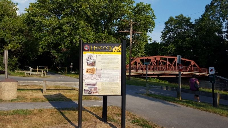
Location. 39° 41.9′ N, 78° 10.691′ W. Marker is in Hancock, Maryland, in Washington County. Marker is at the intersection of North Church Street and Canal Street, on the right when traveling south on North Church Street. Located on the Western Maryland Rail Trail. Touch for map. Marker is in this post office area: Hancock MD 21750, United States of America. Touch for directions.
Other nearby markers. At least 8 other markers are within walking distance of this marker. Hancock Station (here, next to this marker); a different marker also named Hancock (a few steps from this marker); Gettysburg Campaign (a few steps from this marker); St. Thomas Episcopal Church (within shouting distance of this marker); A panorama of the original Maryland-West Virginia river bridge / "The Light House" (within shouting distance of this marker); St. Thomas Church (within shouting distance of this marker); In Honor and Remembrance (about 300 feet away, measured in a direct line); A New Beginning (about 300 feet away). Touch for a list and map of all markers in Hancock.
Also see . . . Hancock Historical Society. Society website homepage (Submitted on July 25, 2016.)
Credits. This page was last revised on April 20, 2022. It was originally submitted on July 25, 2016, by Bernard Fisher of Richmond, Virginia. This page has been viewed 474 times since then and 22 times this year. Photos: 1. submitted on July 25, 2016, by Bernard Fisher of Richmond, Virginia. 2. submitted on April 20, 2022, by Larry Gertner of New York, New York. 3. submitted on July 25, 2016, by Bernard Fisher of Richmond, Virginia.

