Near Lander in Fremont County, Wyoming — The American West (Mountains)
Red Canyon Wildlife Habitat Management Area
Inscription.
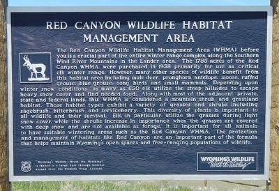
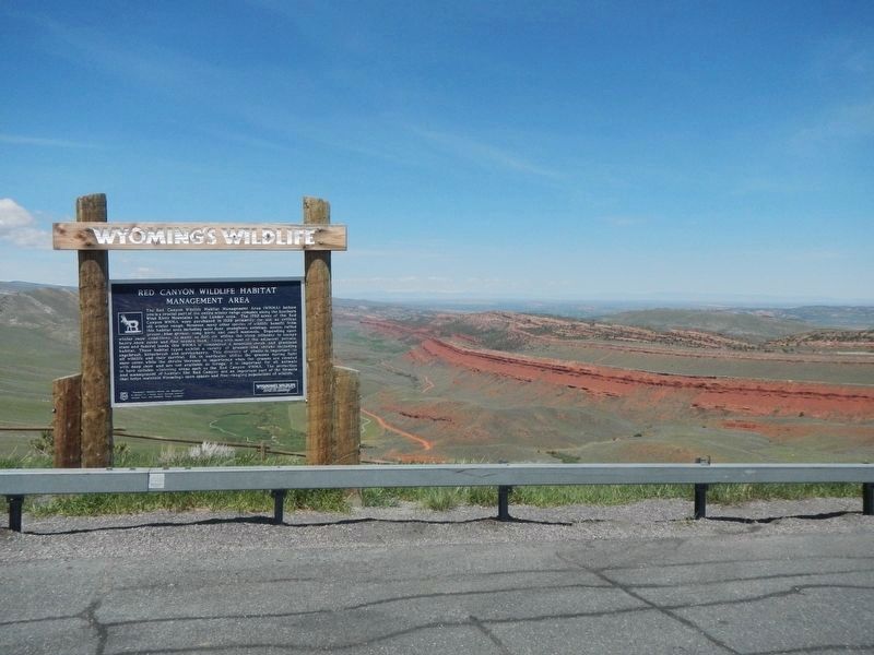
The Red Canyon Wildlife Habitat Management Area (WHMA) before you is a crucial part of the entire winter range complex along the Southern Wind River Mountains in the Lander Area. The 1785 acres of the Red Canyon WHMA were purchased in 1958 primarily for use as critical elk winter range. However, many other species of wildlife benefit from this habitat area including mule deer, pronghorn antelope, moose, ruffed grouse, blue grouse, song birds and small mammals. Depending upon winter snow conditions, as many as 650 elk utilize the steep hillsides to escape heavy snow cover and find needed food. Along with most of the adjacent private, state and federal lands, this WHMA is considered a mountain shrub and grassland habitat. Those habitat types exhibit a variety of grasses and shrubs including sagebrush, bitterbrush and serviceberry. This diversity of plans is important to all wildlife and their survival. Elk, in particular, utilize the grasses during light snow cover, while the shrubs increase in important when the grasses are covered with deep snow and are not available as forage. It is important for all animals to have suitable wintering areas such as the Red Canyon WHMA. The protection and management of habitats like Red Canyon are an important part of the formula that helps maintain Wyoming’s open spaces and free-ranging populations of
wildlife.
Erected by Wyoming Fish and Game Department.
Topics. This historical marker is listed in this topic list: Natural Features. A significant historical year for this entry is 1785.
Location. 42° 36.21′ N, 108° 36.84′ W. Marker is near Lander, Wyoming, in Fremont County. Marker is on Dickinson Avenue (State Highway 28) near Red Canyon Road, on the right when traveling west. Touch for map. Marker is at or near this postal address: 6678 Dickinson Avenue, Lander WY 82520, United States of America. Touch for directions.
Other nearby markers. At least 8 other markers are within 10 miles of this marker, measured as the crow flies. Red Canyon (approx. 1.2 miles away); Miner’s Delight (approx. 5.9 miles away); Local Colour (approx. 5.9 miles away); Fort Stambaugh, 1870-1878 (approx. 7.7 miles away); Miners Delight: The Boom’s Broken Promises (approx. 7.9 miles away); Dallas Dome Oil Field (approx. 8.8 miles away); Gold Flakes to Yellowcake Historic Mine Trail (approx. 9.2 miles away); The Atlantic City Project (approx. 9.2 miles away). Touch for a list and map of all markers in Lander.
Credits. This page was last revised on August 1, 2016. It was originally submitted on August 1, 2016, by Barry Swackhamer of Brentwood, California. This page has been viewed 379 times since then and 16 times this year. Photos: 1, 2. submitted on August 1, 2016, by Barry Swackhamer of Brentwood, California.

