Frostburg in Allegany County, Maryland — The American Northeast (Mid-Atlantic)
Frostburg
Maryland's Mountain City
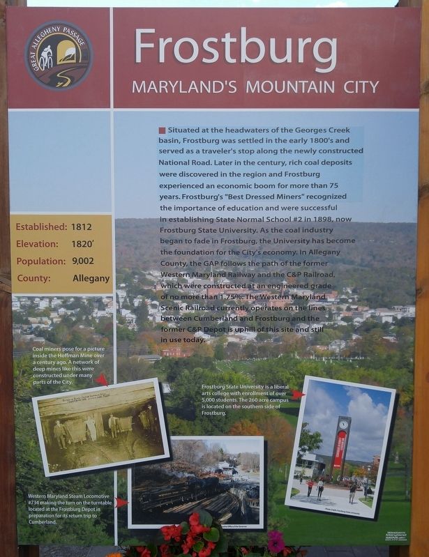
Elevation: 1820'
Population: 9,002
County: Allegany
Situated in the headwaters of the Georges Creek basin, Frostburg was settled in the early 1800's and served as a traveler's stop along the newly constructed National Road. Later in the century, rich coal deposits were discovered in the region and Frostburg experienced an economic boom for more than 75 years. Frostburg's "Best Dressed Miners" recognized the importance of education and were successful in establishing State Normal School #2 in 1893, now Frostburg State University. As the coal industry began to fade in Frostburg, the University has become the foundation for the City's economy. In Allegany County, the GAP follows the path of the former Western Maryland Railway and the C&P Railroad, which were constructed at an engineered grade of no more than 1.75%. The Western Maryland Scenic Railroad currently operates on the lines between Cumberland and Frostburg and the former C&P Depot is uphill of this site and still in use today.
[text with left image] Coal miners pose for a picture inside the Hoffman Mine over a century ago. A network of deep mines like this were constructed under many parts of the city.
[text with bottom image] Western Maryland Steam Locomotive #734 making the turn on the turntable located at the Frostburg Depot in preparation for its return trip to Cumberland.
[text with right image] Frostburg State University is a liberal arts college with enrollment of over 5,000 students. The 260 acre campus is located on the southern side of Frostburg.
[Reverse side of marker]
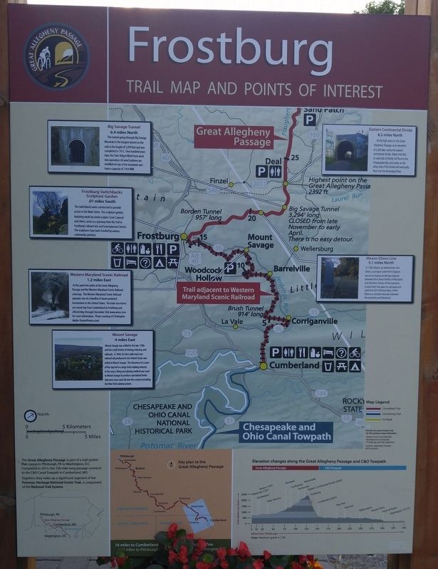
Frostburg - Trial Map and Points of Interest
Big Savage Tunnel - 6.4 miles North - This tunnel going through the Big Savage Mountain is the longest tunnel on the trail at the length of 3,294 feet and was completed in 1912. One hundred years later, the Twin Ridges Wind Farm went into operation; 68 wind turbines are installed on top of the mountain and have a capacity of 139.4 MW.
Frostburg Switchbacks Sculpture Gardens - .01 miles South - The switchbacks were constructed to provide access to the Main Street. The sculpture Scott Cawood and others, serve as a gateway from the Trail to Frostburg's vibrant Arts and Entertainment District. The sculptures have been funded by various community partners.
Western Maryland Scenic Railroad - 1.2 miles East - At the point the paths of the Great Allegheny Passage and Western Maryland Scenic Railroad converge. The Western Maryland Scenic Railroad operates one of a handful of steam-powered locomotives in the United States. The train excursions are round-trip from Cumberland to Frostburg and offered May through December. Visit www.wmsr.com for more information. Photo courtest of Christopher Muller (SteamPhotos.com).
Mount Savage - 4 miles East - Mount Savage was settled in the late 1700s and has a rich history of mining, indusstry, and railroads. In 1844, the first solid-track iron railroad fail produced in the United States was rolled in Mount Savage. The discovery of a seam of ire clay led to a large brick making industry in the area; a firing and glazing method was used in Mount Savage to produce specialized bricks that were once used all over the country including the New York subway system.
Mason-Dixon Line - 5.1 miles North - In 1763, Mason, an astronomer, and Dixon, a surveyor, both from England, set out to resolve an 80-year dispute between the Calvert family of Maryland and the Penn family of Pennsylvania. It took them five years to calculate and mark the 233 mile boundary, which follows a constant latitude between Pennsylvania and Maryland.
Eastern Continental Divide - 8.2 miles North - At the high point on the Great Allegheny Passage, at an elevation of 2,392 feet, marks the eastern continental divide. Water that falls on the east side of the divide will flow to the Chesapeake Bay, and water on the other side of the divide will eventually flow into the Mississippi River.
Topics. This historical marker is listed in these topic lists: Industry & Commerce
• Railroads & Streetcars • Roads & Vehicles • Settlements & Settlers. A significant historical year for this entry is 1812.
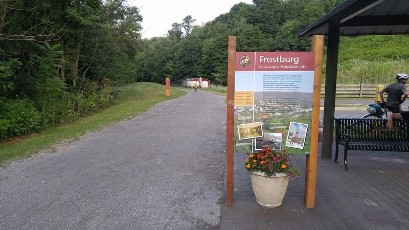
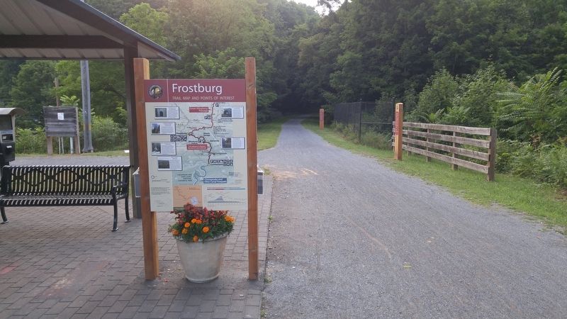
Location. 39° 39.566′ N, 78° 55.301′ W. Marker is in Frostburg, Maryland, in Allegany County. Marker is on New Hope Road, 0.2 miles north of Depot Street, on the right. Marker is near the pavilion next to the Great Allegheny Passage trail. Touch for map. Marker is in this post office area: Frostburg MD 21532, United States of America. Touch for directions.
Other nearby markers. At least 8 other markers are within walking distance of this marker. A different marker also named Frostburg (a few steps from this marker); Coal Mining (a few steps from this marker); The Cumberland and Pennsylvania Railroad (within shouting distance of this marker); The National Road (about 400 feet away, measured in a direct line); Cumberland and Pennsylvania Railroad Depot (approx. 0.2 miles away); The Naming of Frostburg (approx. 0.2 miles away); a different marker also named Frostburg (approx. 0.2 miles away); St. Michael's Parish Hall (approx. 0.3 miles away). Touch for a list and map of all markers in Frostburg.
Credits. This page was last revised on August 1, 2016. It was originally submitted on August 1, 2016, by F. Robby of Baltimore, Maryland. This page has been viewed 519 times since then and 28 times this year. Photos: 1, 2, 3, 4, 5. submitted on August 1, 2016, by F. Robby of Baltimore, Maryland.
