Brocton in Chautauqua County, New York — The American Northeast (Mid-Atlantic)
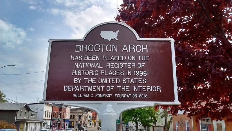
Brocton Arch
Has been placed on the National Register of Historic Places in 1996 by the United States Department of the Interior.
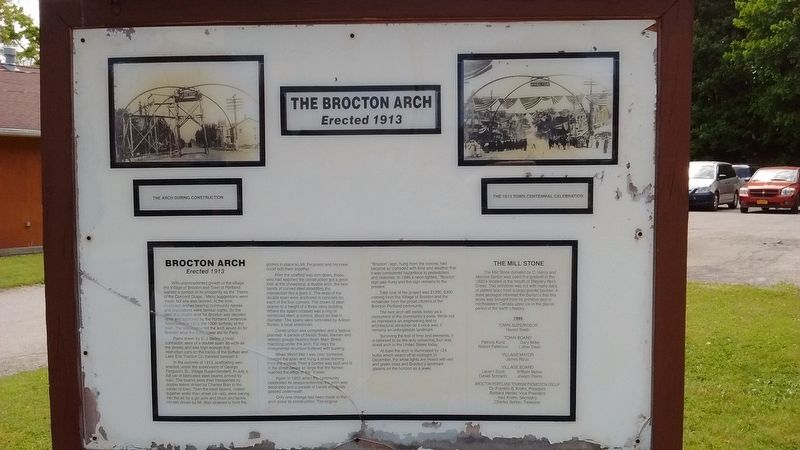
Brocton Arch Erected 1913
With unprecedented growth of the village, the Village of Brocton and Town of Portland wanted a symbol of its prosperity as the "Home of the Concord Grape". Many suggestions were made, but one was favored. At the time, municipal arches bearing community names and populations were familiar sites. So the idea of a double arch for Brocton was decided upon and approved by the Portland Centennial Association in 1913, the 100th birthday of the town. The association felt the arch would do for Brocton what the Eiffel Tower did for Paris.
Plans drawn by E. J. Baily, a local contractor, were of a double span, as wide as the streets and was high enough that interurban cars on the tracks of the Buffalo and lake Erie Traction Co. traveled beneath it.
In the summer of 1913 scaffolding was erected, under the supervision of George Ferguson, Sr., Village Superintendent. In July, a flat car of fabricated steel beams arrived by train. the beams were then transported by double teams driven by Charles Blair to the center of town. Then the steel beams, riveted together wider that street car rails, were swung into the air by a gin pole and block and tackle. Horses driven by Mr. Blair strained to hold the girders in place so Mr. Ferguson and his crew could bolt them together.
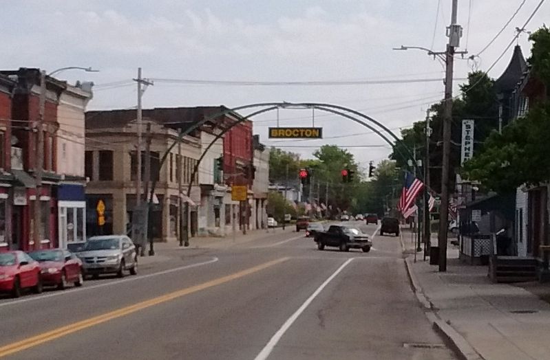
After the scaffold was torn down, those who had watched the construction got a good look at the showpiece, a double arch, the twin bands of curved steel straddling the intersection like a giant X. The ends of the double span were anchored in concrete on each of the four corners. The crown of steel soared to a height of a three-story building. Where the spans crossed was a ring of reinforced steel, a corona, about six feet in diameter. The spans were luminated by Adison Burton, a local Electrician.
Construction was completed and a festival planned. A parade of bands, floats, firemen and veteran groups headed down Main Street marching under the arch. For days the monumental structure fluttered with bunting.
When World War I was over, someone climbed the span and hung a straw dummy from the corona. Then a bonfire was built and lit in the street below, so large that the flames reached the effigy of the "Kaiser".
Again, in 1963, when the community celebrated its sesquicentennial, the arch was decorated and a parade of bands and floats passed underneath.
Only one change has been made to the arch since its construction. The original "Brocton" sign, hung from the corona, had become so corroded with time and weather that it was considered hazardous to pedestrians and motorists. In 1946 a neon lighted, "Brocton" sign was hung and the sign remains to the present.
Total cost of the project was $1200, $300 coming from the Village of Brocton and the remainder from the proud citizens of the Brocton-Portland community.
The twin arch still exists today as a monument of the community's pride. While not as impressive an engineering feat or architectural attraction as it once was, it remains an unforgettable landmark.
Surviving the test of time and elements, it is believed to be the only remaining four-way street arch in the United States today.
At dusk the arch is illuminated by 124 bulbs which switch off at midnight. in December, the white lights are mixed with red and green ones and Brocton's landmark gleams on the horizon as a jewel.
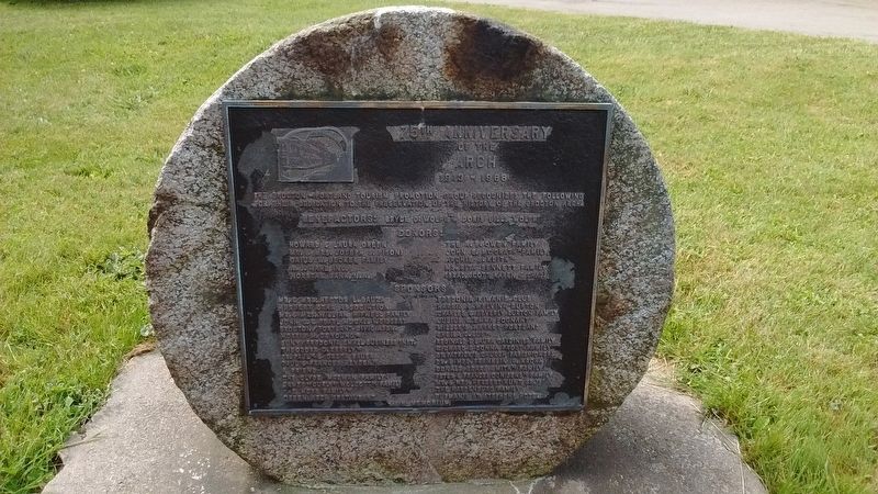
The Mill Stone
the Mill Stone donated by C. Harris and Melvina Burton was used in a gristmill in the 1820's located at the mouth of Slippery Rock Creek. This millstone was cut with many days of patient labor from a large granite boulder. A state geologist informed the Burton's that this stone was brought from its primitive bed in northeastern Canada upon ice in the glacial period of the earth's history.
1988
Town Supervisor - Harold Smith
Town Board - Patricia Kurtz, Gary Miller, Robert Patterson, Luther Dean.
Village Mayor - James Rizzo
Village Board - Lavern Scott, William Maher, daniel Schrantz, Joseph Pisoni
Brocton Portland Tourism Promotion Group - Dr. Franklin B. Krohn, President. Barbara Herbst, Vice President. Inez Krohn, Secretary. Charles Burton, Treasurer.
Erected 2013 by William G. Pomeroy Foundation.
Topics and series. This historical marker is listed in this topic list: Architecture. In addition, it is included in the William G. Pomeroy Foundation series list. A significant historical year for this entry is 1913.
Location. 42° 23.317′ N, 79° 26.45′ W. Marker is in Brocton, New York, in Chautauqua County. Marker is at the intersection of West Main Street (U.S. 20) and Highland Avenue, in the median on West Main Street. Touch for map. Marker is in this post office area: Brocton NY 14716, United States of America. Touch for directions.
Other nearby markers. At least 8 other markers are within 7 miles of this marker, measured as the crow flies. Ships and Shipwrecks at Lake Erie State Park (approx. 2.6 miles away); Lily Dale Assembly (approx. 6.4 miles away); The Site of the First Gas Well (approx. 6˝ miles away); Fredonia #1 (approx. 6˝ miles away); Abell Inn Site (approx. 6.6 miles away); Barker Common (approx. 6.6 miles away); Commander William B. Cushing (approx. 6.6 miles away); Dedicated to Veterans (approx. 6.6 miles away).
Also see . . . Brocton Arch. National Register of Historic Places form, National Archives. (Submitted on September 19, 2023, by Anton Schwarzmueller of Wilson, New York.)
Credits. This page was last revised on September 19, 2023. It was originally submitted on August 8, 2016, by Tom Bosse of Jefferson City, Tennessee. This page has been viewed 1,057 times since then and 79 times this year. Photos: 1, 2, 3, 4. submitted on August 8, 2016, by Tom Bosse of Jefferson City, Tennessee. • Bill Pfingsten was the editor who published this page.


