Bedminster in Somerset County, New Jersey — The American Northeast (Mid-Atlantic)
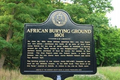
African Burying Ground
1801
On June 22, 1801, three African American Men - one free Negro and two slaves - purchased one tenth on an acre of land from Aaron Melick for the sum of three dollars to establish a burying ground for the "Black people of the Neighborhood." This is the earliest known purchase of land by slaves for burials in New Jersey. The free Negro's name was Robert Aaron, a local bee keeper, and the two slaves were Aaron Melick's Robert and Aaron Van Doren's Yaff.
The burying ground is one square chain (66" x 66") -bounded on the west by Hillside Avenue. In the 1889 book "The Story of an Old Farm," Andrew D. Melick, Jr. refers to the site as "Gods Acre".
Erected 2016 by Township of Bedminster.
Topics. This historical marker is listed in these topic lists: African Americans • Cemeteries & Burial Sites. A significant historical date for this entry is June 22, 1801.
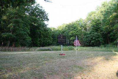
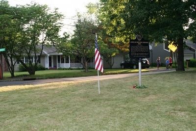
Location. 40° 41.003′ N, 74° 38.901′ W. Marker is in Bedminster, New Jersey, in Somerset County. Marker is at the intersection of Hillside Avenue and Steeple Chase Court, on the right when traveling north on Hillside Avenue. The marker is located .25 miles north of the intersection of U.S. Route 202 and Hillside Avenue. Touch for map. Marker is at or near this postal address: 130 Hillside Avenue, Bedminster NJ 07921, United States of America. Touch for directions.
Other nearby markers. At least 8 other markers are within 2 miles of this marker, measured as the crow flies. Bedminster War Memorials (approx. 0.3 miles away); Far Hills War Monument (approx. half a mile away); Melick Home (approx. half a mile away); Peapack Brook Rural Industrial Historic District (approx. 0.6 miles away); Far Hills Station (approx. 0.8 miles away); The Jacobus Vanderveer House (approx. 1.2 miles away); a different marker also named The Jacobus Vanderveer House (approx. 1.2 miles away); "Natirar" (approx. 1.2 miles away). Touch for a list and map of all markers in Bedminster.
More about this marker. The property is owned by the Township of Bedminster and was the former location of the municipal building which has been demolished. In 2013 the Township approved an ordinance that subdivided the parcel believed to be the site of the cemetery. The subdivision carries a deed restriction that the parcel will be preserved.
Regarding African Burying Ground. This site is one of the earliest known land purchases by blacks who were not allowed to own land in the state until after the Revolutionary War. It is the only known purchase of land for the purpose of creating a burial ground for blacks at a time when slaves often were buried in unmarked graves on their masters' property.
The sign was funded by the Somerset County Board of Chosen Freeholders through the Somerset County Historic Preservation Grant Program.

Photographed By Thomas R. D'Amico, January 1, 2000
4. African Burying Ground Marker
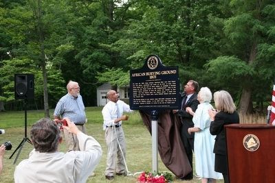
Marker unveiling on June 20, 2016.
Story of lost graveyard is unearthed:
True Jersey website entry
Click for more information.
Story of lost graveyard is unearthed:
True Jersey website entry
Click for more information.
Credits. This page was last revised on December 1, 2021. It was originally submitted on June 21, 2016, by Thomas R. D'Amico of Somerville, New Jersey. This page has been viewed 719 times since then and 66 times this year. Last updated on August 12, 2016, by Thomas R. D'Amico of Somerville, New Jersey. Photos: 1, 2, 3, 4. submitted on June 21, 2016, by Thomas R. D'Amico of Somerville, New Jersey. • Bill Pfingsten was the editor who published this page.


