Near Big Piney in Sublette County, Wyoming — The American West (Mountains)
Crossing the New Fork River

Photographed By Barry Swackhamer, June 2, 2016
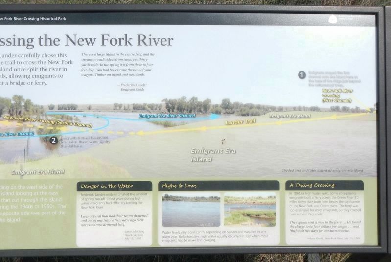
1. Crossing the New Fork River Marker
Captions: Diagram of the New Fork River Crossing ❶ Emigrants crossed the first channel on the island here at the base of the ridge just beyond the cottonwood trees; ❷ Emigrants crossed the second channel at the now mostly dry channel here.
Click on the image to enlarge it.
Click on the image to enlarge it.
There is a large island in the centre (sic), and the stream on each side is from twenty to thirty yards wide. In the spring it s form three to four feet deep. You had better raise the beds of your wagons. Timber on island and west bank. - Frederick Lander, Emigrant Guide
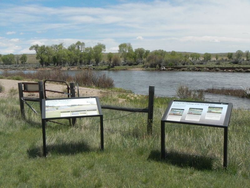
You are standing on the west side of the emigrant era island looking at the new river channel that cut through the island sometimes during the 1940s or 1950s. The bank on the opposite side was part of the east side of the island.
I seen several that had their teams drowned and out of of one train a few days ago their were two men drowned (sic). - James McClung, New Fork River, July 19, 1862
The captain sent a man to the ferry... He found the charge to be four dollars per wagon... and (the) wait two days of our turn to come. - Jane Gould, New Fork River, July 20, 1862.
Erected by Sublette County Historical Society.
Topics. This historical marker is listed in these topic lists: Roads & Vehicles • Settlements & Settlers.
Location. 42° 36.828′ N, 109° 51′ W. Marker is near Big Piney, Wyoming, in Sublette County. Marker can be reached from Paradise Road near Wyoming 351 (Wyoming Highway 351), on the right when traveling north. Touch for map. Marker is at or near this postal address: 1398 Paradise Road, Big Piney WY 83113, United States of America. Touch for directions.
Other nearby markers. At least 8 other markers are within 10 miles of this marker, measured as the crow flies. Rising to the Challenge of the New Fork River (a few steps from this marker); The First Engines: Oxen, Mules, and Horses (about 700 feet away, measured in a direct line); "We Busy Ourselves in Various Ways"
(approx. 0.2 miles away); "Hear Was Hundreds of Emigrants" (approx. 0.2 miles away); Building the Lander Trail (approx. ¼ mile away); 19th Century Interstate Highway (approx. ¼ mile away); New Fork River Crossing (approx. 0.4 miles away); Sand Springs - A Stop on the Oregon Trail (approx. 9.8 miles away). Touch for a list and map of all markers in Big Piney.
More about this marker. This marker is located in Lander Trail New Fork River Crossing Historic Park
Credits. This page was last revised on December 10, 2016. It was originally submitted on August 14, 2016, by Barry Swackhamer of Brentwood, California. This page has been viewed 349 times since then and 15 times this year. Photos: 1, 2. submitted on August 14, 2016, by Barry Swackhamer of Brentwood, California.
