Paris in Lamar County, Texas — The American South (West South Central)
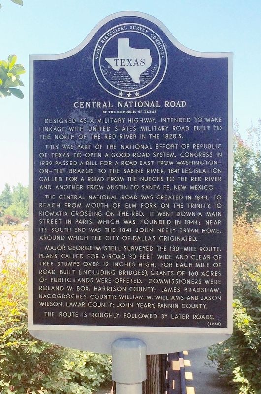
Central National Road
of the Republic of Texas
This was part of the national effort of Republic of Texas to open a good road system. Congress in 1839 passed a bill for a road east from Washington-on-the-Brazos to the Sabine River; 1841 legislation called for a road from the Nueces to the Red River and another from Austin to Santa Fe, New Mexico.
The Central National Road was created in 1844, to reach from mouth of Elm Fork on the Trinity to Kiomatia Crossing on the Red. It went down a main street in Paris, which was founded in 1844; near its south end was the 1841 John Neely Bryan home around which the city of Dallas originated.
Major George W. Stell surveyed the 130-mile route. Plans called for a road 30 feet wide and clear of tree stumps over 12 inches high. For each mile of road built (including bridges), grants of 160 acres of public lands were offered. Commissioners were Roland W. Box, Harrison County; James Bradshaw, Nacogdoches County; William M. Williams and Jason Wilson, Lamar County; John Yeary, Fannin County.
The route is roughly followed by later roads.
Erected 1968 by State Historical Survey Committee. (Marker Number 8188.)
Topics. This historical marker is listed in these topic lists: Bridges & Viaducts • Roads & Vehicles. A significant historical year for this entry is 1839.
Location. 33° 39.634′ N, 95° 34.023′ W. Marker is in Paris, Texas, in Lamar County. Marker is at the intersection of Bonham Street (Business U.S. 82) and West Kaufman Street, on the right when traveling east on Bonham Street. Touch for map. Marker is at or near this postal address: 1125 Bonham Street, Paris TX 75460, United States of America. Touch for directions.
Other nearby markers. At least 8 other markers are within walking distance of this marker. Union Station (within shouting distance of this marker); First Presbyterian Church (approx. 0.4 miles away); Old Cemetery of Paris (approx. half a mile away); Burial Site of John S. Chisum (approx. half a mile away); Paris (approx. half a mile away); The Paris Fire, 1916 (approx. 0.6 miles away); John James Culbertson (approx. 0.6 miles away); Lamar County, C. S. A. (approx. 0.6 miles away). Touch for a list and map of all markers in Paris.
Also see . . . Texas State Historical Association article on the National Road. (Submitted on August 15, 2016, by Mark Hilton of Montgomery, Alabama.)

Photographed By Mark Hilton, July 21, 2016
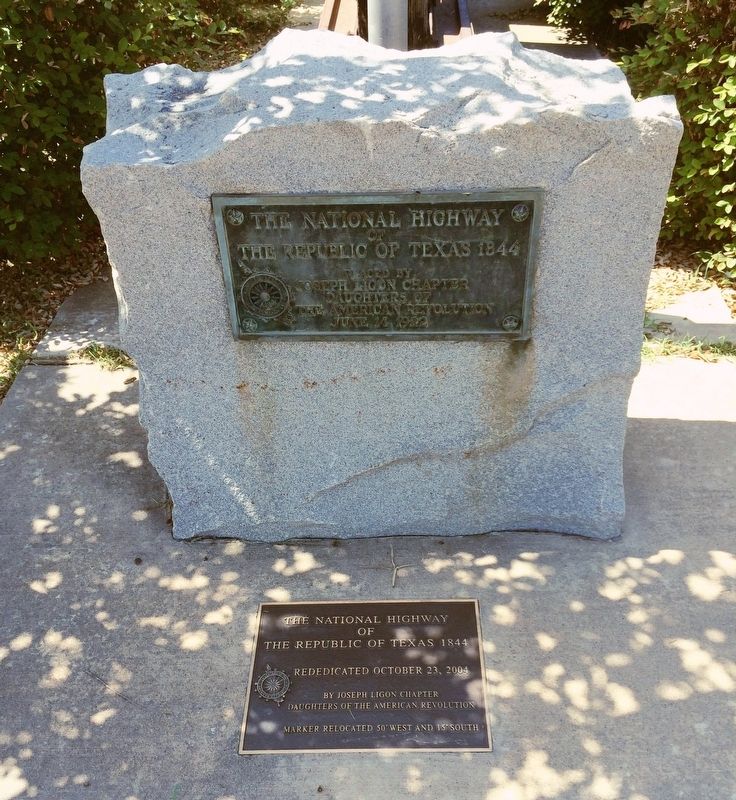
3. The National Highway of the Republic of Texas 1844 plaques below this marker.
The Republic of Texas 1844
Placed by
Joseph Ligon Chapter
Daughters of the American Revolution
June 14 1922
2nd Plaque
The Republic of Texas 1844
Rededicated October 23, 2004
By Joseph Ligon Chapter
Daughters of the American Revolution
Marker Relocated 50' West and 15'South
Credits. This page was last revised on March 29, 2024. It was originally submitted on August 15, 2016, by Mark Hilton of Montgomery, Alabama. This page has been viewed 763 times since then and 103 times this year. Photos: 1, 2, 3. submitted on August 15, 2016, by Mark Hilton of Montgomery, Alabama.

