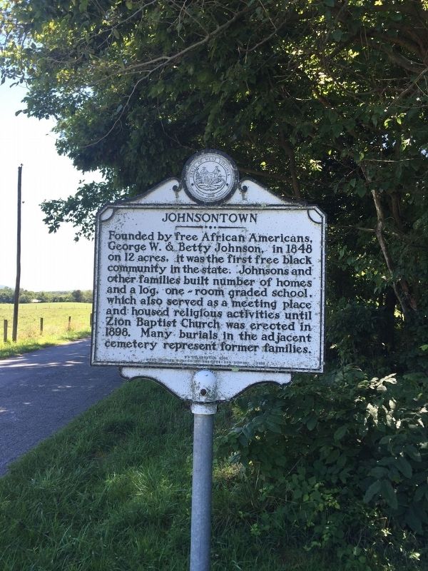
Near Kearneysville in Jefferson County, West Virginia — The American South (Appalachia)
Johnsontown
Erected 2000 by West Virginia Division of Culture and History.
Topics and series. This historical marker is listed in these topic lists: African Americans • Agriculture • Settlements & Settlers. In addition, it is included in the West Virginia Archives and History series list. A significant historical year for this entry is 1848.
Location. 39° 20.43′ N, 77° 53.444′ W. Marker is near Kearneysville, West Virginia, in Jefferson County. Marker is on Johnsontown Road just east of Hite Road, on the left when traveling west. Touch for map. Marker is at or near this postal address: 2546 Johnsontown Rd, Kearneysville WV 25430, United States of America. Touch for directions.
Other nearby markers. At least 8 other markers are within 3 miles of this marker, measured as the crow flies. Gap View Farm (approx. 1.9 miles away); Peter Burr House (approx. 2 miles away); Peter Burr / William Burr Houses (approx. 2 miles away); Hockensmith Apple Storage Building (approx. 2 miles away); Valley View / Tackley Farm (approx. 2.1 miles away); The Greenback Raid (approx. 2.1 miles away); “The Bower” (approx. 2.2 miles away); "Prato Rio" (approx. 2.4 miles away). Touch for a list and map of all markers in Kearneysville.
Credits. This page was last revised on December 26, 2023. It was originally submitted on August 30, 2016, by William Glahn of Winchester, Virginia. This page has been viewed 686 times since then and 45 times this year. Last updated on December 25, 2023, by Carl Gordon Moore Jr. of North East, Maryland. Photo 1. submitted on August 30, 2016, by William Glahn of Winchester, Virginia. • Devry Becker Jones was the editor who published this page.
