Near Nixon in Washoe County, Nevada — The American Mountains (Southwest)
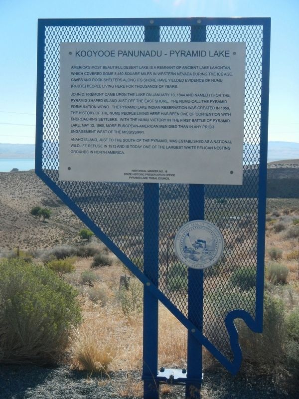
Kooyooe Panunadu - Pyramid Lake
America's most beautiful desert lake is a remnant of ancient Lake Lahontan, which covered some 8,450 square miles in western Nevada during the Ice Age. Caves and rock shelters along its shore have yielded evidence of Numu (Paiute) people living here for thousands of years.
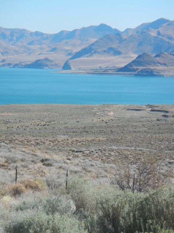
John C. Frémont came upon the lake on January 10, 1844 and named it for the pyramid-shaped island just off the east shore. The Numu called the pyramid formulation (sic) Wono. The Pyramid Lake Indian Reservation was created in 1959. The history of the Numu people living here has been one of contention with encroaching settlers. With the Numu victory in the First Battle of Pyramid Lake, May 12, 1860, more European-American men died than in any other prior engagement west of the Mississippi.
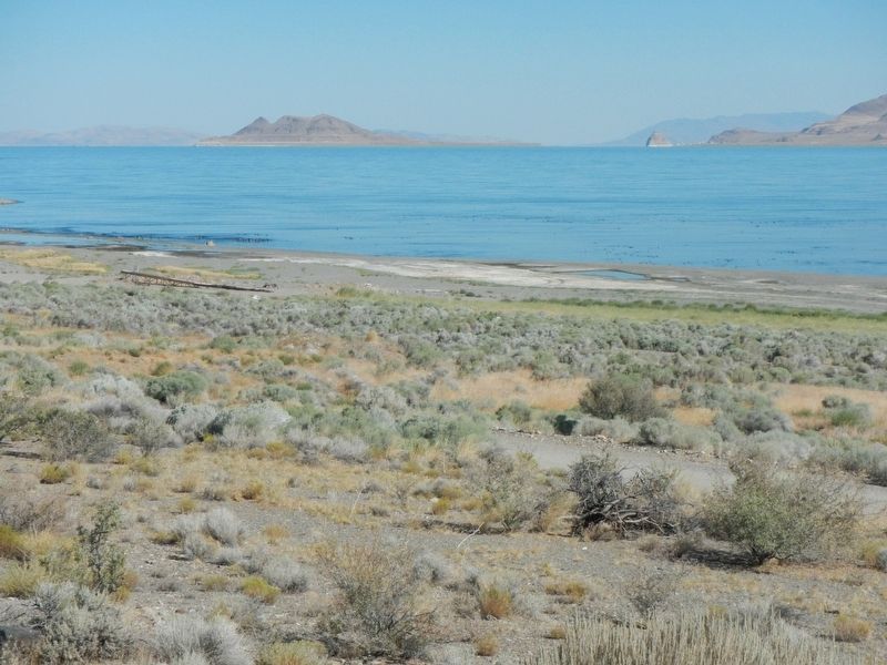
Anaho Island, just to the south of the Pyramid, was established as a national wildlife refuge in 1913 and is today one of the largest White Pelican nesting grounds in North America.
Erected by State Historic Preservation Office, Pyramid Lake Tribal Office. (Marker Number 18.)
Topics. This historical marker is listed in these topic lists: Exploration • Native Americans • Natural Features. A significant historical date for this entry is January 10, 1844.
Location. 39° 54.156′ N, 119° 33.942′ W. Marker is near Nixon, Nevada, in Washoe County. Marker is on Pyramid Lake Road (Nevada Route 445) near Sutcliffe Highway (Nevada Route 445), on the right when traveling north. Touch for map. Marker is at or near this postal address: 28460 Pyramid Lake Road, Nixon NV 89424, United States of America. Touch for directions.
Other nearby markers. At least 1 other marker is within 7 miles of this marker, measured as the crow flies. Guanomi Mine (approx. 7.1 miles away).
Also see . . . Pyramid Lake. The Nevada Travel Network website entry:
Despite the enormous changes which have overtaken the world since Fremont's visit in 1844, Pyramid Lake (which he named for a tufa rock formation on the eastern shore) remains as strikingly beautiful and as enchanting as it was before he came. (Submitted on September 8, 2016, by Barry Swackhamer of Brentwood, California.)
Photographed By Barry Swackhamer, August 25, 2016
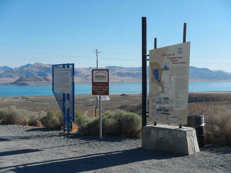
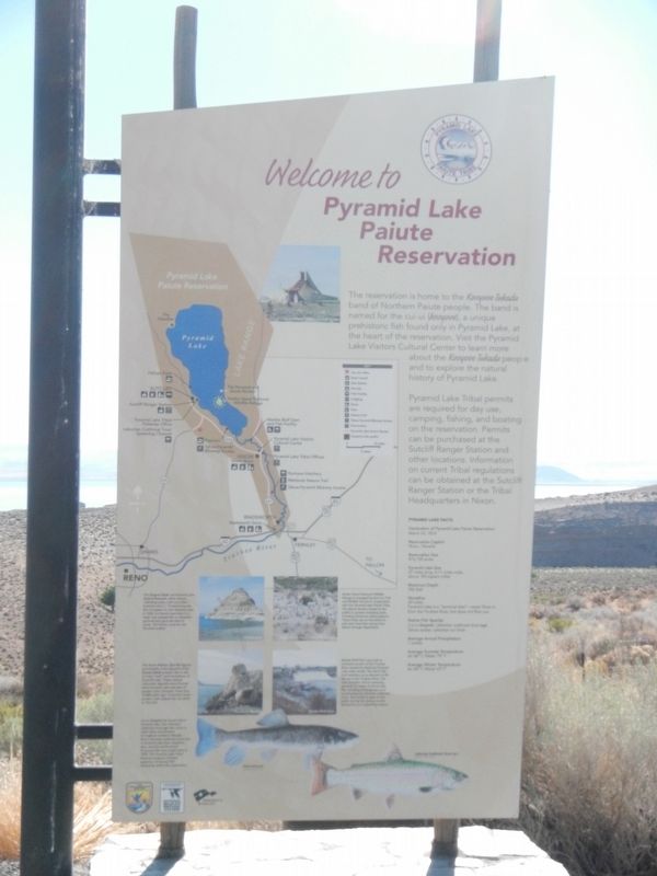
3. Welcome to Pyramid Lake Paiute Reservation
The reservation is home to the Kooyooe Tukadu band Northern Paiute people. The band is named for the cui-ui (kooyooe), a unique prehistoric fish found only in Pyramid Lake, at the heart of the reservation. Visit the Pyramid Lake Visitors Cultural Center to learn more about the Kooyooe Tukadu people and to explore the natural history of Pyramid Lake.
Pyramid Lake Tribal permits are required for day use, camping, fishing, and boating on the reservation. Permits can be purchased at the Sutcliff Ranger Station and other locations. Information on current tribal regulations can be obtained at the Sutcliff Ranger Station oar the Tribal Headquarters in Nixon.
Pyramid Lake Facts
Declaration of Pyramid Lake Paiute Reservation: March 23, 1874
Reservation Capitol: Nixon, Nevada
Reservation Size: 476,728 acres
Pyramid Lake Size: 27 miles long, 4 -11 miles wide, about 183 square miles
Maximum Depth: 356 feet
Shoreline: 69 miles, Pyramid Lake is a "terminal lake" -- water flows in from the Truckee River, but does not flow out.
Native Fish Species: Cui-ui (kaoyeoi), Lahontan cutthroat trout (agi), Tahoe sucker, Lahotan tui chub
Average Annual Precipitation: 7 inches
Average Summer Temperature: Air 86º F, Water 75º F
Average Winter Temperature: Air 45º F, Water 43º F
Click on this image to enlarge it and read the photograph captions.
Pyramid Lake Tribal permits are required for day use, camping, fishing, and boating on the reservation. Permits can be purchased at the Sutcliff Ranger Station and other locations. Information on current tribal regulations can be obtained at the Sutcliff Ranger Station oar the Tribal Headquarters in Nixon.
Reservation Capitol: Nixon, Nevada
Reservation Size: 476,728 acres
Pyramid Lake Size: 27 miles long, 4 -11 miles wide, about 183 square miles
Maximum Depth: 356 feet
Shoreline: 69 miles, Pyramid Lake is a "terminal lake" -- water flows in from the Truckee River, but does not flow out.
Native Fish Species: Cui-ui (kaoyeoi), Lahontan cutthroat trout (agi), Tahoe sucker, Lahotan tui chub
Average Annual Precipitation: 7 inches
Average Summer Temperature: Air 86º F, Water 75º F
Average Winter Temperature: Air 45º F, Water 43º F
Click on this image to enlarge it and read the photograph captions.
Credits. This page was last revised on October 3, 2022. It was originally submitted on September 8, 2016, by Barry Swackhamer of Brentwood, California. This page has been viewed 500 times since then and 22 times this year. Photos: 1, 2, 3, 4, 5. submitted on September 8, 2016, by Barry Swackhamer of Brentwood, California.
