College Park in Prince George's County, Maryland — The American Northeast (Mid-Atlantic)
Architectural History of the Maryland Agricultural College
Inscription.
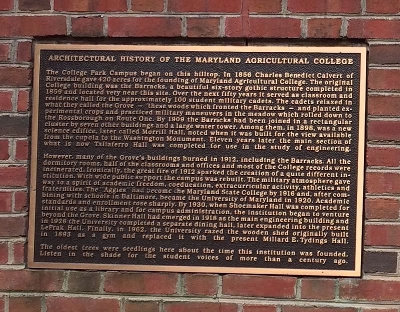
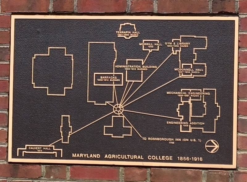
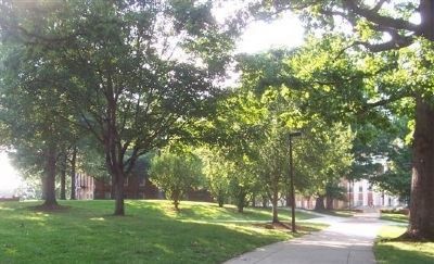
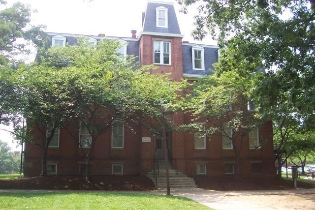
The College Park Campus began on this hilltop. In 1856, Charles Benedict Calvert of Riversdale gave 420 acres for the founding of Maryland Agricultural College. The original College building was the Barracks, a beautiful six-story gothic structure completed in 1859 and located very near this site. Over the next fifty years it served as classroom and residence hall for the approximately 100 student military cadets. The cadets relaxed in what they called the Grove - these woods which fronted the Barracks - and planted experimental crops and practiced military maneuvers in the meadow which rolled down to the Rossborough on Route One. By 1909, the Barracks had been joined in a rectangular cluster by seven other buildings and a large water tower. Among them, in 1898, was a new science edifice, later called Morrill Hall, noted when it was built for the view available from the cupola to the Washington Monument. Eleven years later the main section of what is now Taliaferro Hall was completed for use in the study of engineering.
However, many of the Grove’s buildings burned in 1912, including the Barracks. All the dormitory rooms, half of the classrooms and offices, and most of the College records were incinerated. Ironically, the great fire of 1912 sparked the creation of a quite different institution. With wide public support, the campus was rebuilt. The military atmosphere gave way to a spirit of academic freedom, coeducation, extracurricular activity, athletics and fraternities. The “Aggies” had become the Maryland State College by 1916 and, after combining with schools in Baltimore, became the University of Maryland in 1920. Academic standards and enrollment rose sharply. By 1930, when Shoemaker Hall was completed for initial use as a library and for campus administration, the institution began to venture beyond the Grove. Skinner Hall had emerged in 1918 as the main engineering building and in 1928 the University completed a separate dining hall, later expanded into the present LaFrak Hall. Finally, in 1962, the University razed the wooden shed originally built in 1893 as a gym and replaced it with the present Millard E. Tydings Hall.
The oldest trees were seedlings here about the time this institution was founded. Listen in the shade for the student voices of more than a century ago.
Erected by University of Maryland.
Topics. This historical marker is listed in these topic lists: Education • Notable Places. A significant historical year for this entry is 1856.
Location. 38° 59.037′ N, 76° 56.59′ W. Marker is in College Park, Maryland, in Prince George's County. Marker can be reached from Chapel Drive
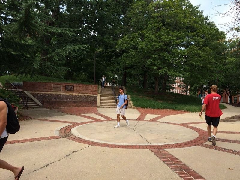
. Marker is on the brick retaining wall at the southeast edge of the "Grove," lying between Preinkert and Chapel Drives on the campus of the University of Maryland. Touch for map. Marker is at or near this postal address: 1101 Chapel Drive, College Park MD 20740, United States of America. Touch for directions.
Other nearby markers. At least 8 other markers are within walking distance of this marker. Morrill Hall (about 300 feet away, measured in a direct line); Vietnam War Memorial (about 300 feet away); Millard E. Tydings (about 400 feet away); Calvert Hall (about 400 feet away); Woods Hall Rain Garden (about 500 feet away); Omicron Delta Kappa (about 700 feet away); Class of 2002 (about 800 feet away); University of Maryland Memorial Chapel (about 800 feet away). Touch for a list and map of all markers in College Park.
Also see . . .
1. Justin Smith Morrill, 1810-1898. Author of the Morrill Land-Grant College Act of 1862, U.S. Congressman and Senator from Vermont for whom Morrill Hall is named. (Submitted on August 1, 2008, by Richard E. Miller of Oxon Hill, Maryland.)
2. Charles Benedict Calvert. (Submitted on August 1, 2008, by Richard E. Miller of Oxon Hill, Maryland.)
Credits. This page was last revised on March 22, 2023. It was originally submitted on August 1, 2008, by Richard E. Miller of Oxon Hill, Maryland. This page has been viewed 2,189 times since then and 51 times this year. Photos: 1. submitted on January 9, 2022, by Adam Margolis of Mission Viejo, California. 2. submitted on August 1, 2008, by Richard E. Miller of Oxon Hill, Maryland. 3, 4. submitted on January 9, 2022, by Adam Margolis of Mission Viejo, California. 5, 6. submitted on August 1, 2008, by Richard E. Miller of Oxon Hill, Maryland. • Kevin W. was the editor who published this page.
