Lebanon in Grafton County, New Hampshire — The American Northeast (New England)
Colburn Park
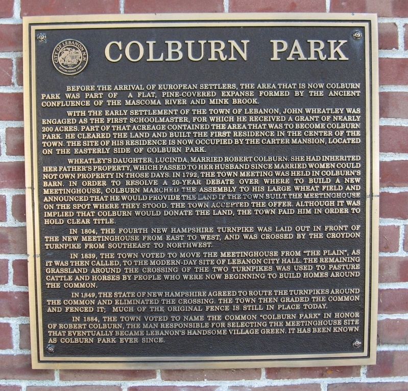
With the early settlement of the Town of Lebanon, John Wheatley was engaged as the first schoolmaster, for which he received a grant of nearly 200 acres. Part of that acreage contained the area that was to become Colburn Park. He cleared the land and built the first residence in the center of the town. The site of his residence is now occupied by the Carter Mansion located on the easterly side of Colburn Park.
Wheatley’s daughter Lucinda, married Robert Colburn. She had inherited her father's property, which passed to her husband since married women could not own property in those days. In 1792, the town meeting was held in Colburn’s barn. In order to resolve a 20-year debate over where to build a new meetinghouse, Colburn marched the assembly to his large wheat field and announced that he would provide the land if the town built the meetingelouse on the spot where they stood. The town accepted the offer. Although it was implied that Colburn would donate the land, the town paid him in order to hold clear title.
In 1804, the fourth New Hampshire Turnpike was laid out in front of the new meetinghouse from east to west, and was crossed by the Croydon Turnpike from southeast to northwest.
In 1839, the town voted to move the meetinghouse from “The Plain”, as it was then called, to the modern-day site of Lebanon City Hall the remaining grassland around the crossing of the two turnpikes was used to pasture cattle and horses by people who re now beginning to build homes around the common.
In 1849, the State of New Hampshire agreed to route the turnpikes around common and eliminated the crossing. The town then graded the common and fenced it, much of the original fence is still in place today.
In 1884, the town voted to name the common "Colburn Park” in honor of Robert Colburn, the man responsible for selecting the meetinghouse site that eventually became Lebanon’s handsome village green. It has been known as Colburn Park ever since.
Topics. This historical marker is listed in these topic lists: Parks & Recreational Areas • Waterways & Vessels.
Location. 43° 38.547′ N, 72° 15.052′ W. Marker is in Lebanon, New Hampshire, in Grafton County. Marker can be reached from the intersection of S. Park Street and Bank Street, on the left when traveling east. Located in Colburn Park. Touch for map. Marker is in this post office area: Lebanon NH 03766, United States of America. Touch for directions.
Other nearby markers. At least 8 other markers are within 4 miles of this marker, measured as the crow flies. Lebanon World War I Monument (a few steps from this marker); Lebanon Veterans Monument (a few steps from this marker); Lebanon Soldiers of the American Revolution (within shouting distance of this marker); City of Lebanon Spruce Tree (approx. 1.7 miles away); Boston & Maine (approx. 3.4 miles away in Vermont); B & M Engine 494 Restoration Project (approx. 3.4 miles away in Vermont); Town of Hartford Veterans Memorial (approx. 3.4 miles away in Vermont); Cross-Abbott / Vermont Salvage (approx. 3.4 miles away in Vermont). Touch for a list and map of all markers in Lebanon.
Credits. This page was last revised on November 24, 2019. It was originally submitted on September 23, 2016, by Michael Herrick of Southbury, Connecticut. This page has been viewed 399 times since then and 18 times this year. Photos: 1, 2, 3. submitted on September 23, 2016, by Michael Herrick of Southbury, Connecticut.


