Early Elk Rapids and the Elk River
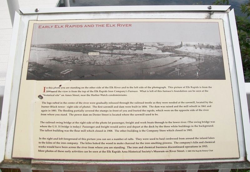
In this photo you are standing on the other side of the Elk River and to the left side of the photograph. This picture of Elk Rapids is from the 1890s and the view is from the top of the Elk Rapids Iron Company's Furnace. What is left of this furnace's foundation can be seen at the "historical site" on Ames Street, near the Harbor Watch condominiums.
The logs rafted in the center of the river were gradually released through the railroad trestle as they were needed at the sawmill, located by the burner (black tower - right side of photo). The first sawmill and dam were built in 1856. The dam was raised and the mill rebuilt in 1861 and again in 1881. The flooding partially covered the stumps in front of you and buried the rapids, which were on the opposite side of the river from where you stand. The power dam on Dexter Street is located where the sawmill used to be.
The railroad swing bridge at the right side of the photo let passenger, freight and work boats through to the lower river. (The swing bridge was where the U.S. 31 bridge is today.) Passenger and freight would arrive and depart at the dock by the three white buildings in the background. The tallest building was the flour mill which closed in 1908. The other building is the Company Store which closed in 1902.
In the right and left foreground of this picture
you can see a number of rafts. They were used to haul cordwood from around the inland lakes to the kilns of the iron company. The kilns baked the wood to make charcoal for the iron smelting process. The company's kiln and chemical works would have been across the river from where you are standing. The iron and chemical business discontinued operations in 1915. More photos of these early activities can be seen at the Elk Rapids Area Historical Society's Museum on River Street.
©2005 Elk Rapids Rotary Club
Erected 2005 by Rotary Club of Elk Rapids.
Topics and series. This historical marker is listed in these topic lists: Horticulture & Forestry • Industry & Commerce • Waterways & Vessels. In addition, it is included in the Rotary International series list. A significant historical year for this entry is 1856.
Location. 44° 53.803′ N, 85° 24.56′ W. Marker is in Elk Rapids, Michigan, in Antrim County. Marker is on the east side of the Rotary Park Pavilion, which is on the right while traveling north on U.S. 31. Touch for map. Marker is at or near this postal address: Rotary Park, 305 US 31, Elk Rapids MI 49629, United States of America. Touch for directions.
Other nearby markers. At least 8 other markers are within walking distance of this marker. Elk River, Entry to the Chain of Lakes of Antrim County (here, next to this marker); Elk Rapids (here, next to this marker); Land of Anishinabek
Also see . . . Elk Rapids Waterfront Cultural Landscape Report. (Submitted on September 25, 2016, by William Fischer, Jr. of Scranton, Pennsylvania.)
Credits. This page was last revised on December 7, 2020. It was originally submitted on September 25, 2016, by William Fischer, Jr. of Scranton, Pennsylvania. This page has been viewed 531 times since then and 72 times this year. Photos: 1, 2. submitted on September 25, 2016, by William Fischer, Jr. of Scranton, Pennsylvania.

