Tonawanda in Erie County, New York — The American Northeast (Mid-Atlantic)
Engineering the Erie Canal
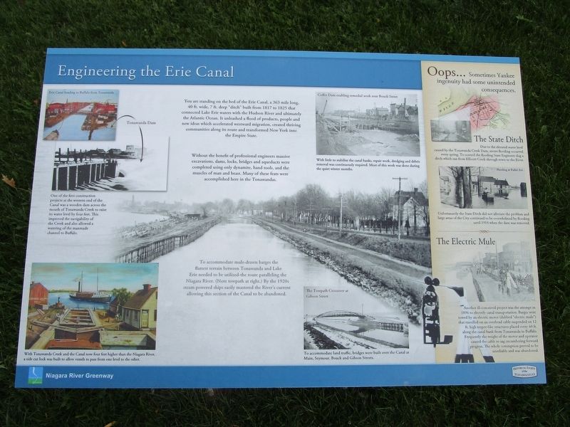
Without the benefit of professional engineers massive excavations, dams, locks, bridges and aqueducts were completed using only dynamite, hand tools, and the muscles of man and beast. Many of these feats were accomplished here in the Tonawandas.
To accommodate mule-drawn barges the flattest terrain between Tonawanda and Lake Erie needed to be utilized - the route paralleling the Niagara River. (Note towpath at right.) By the 1920s steam powered ships easily mastered the River's current allowing this section of the Canal to be abandoned.
Tonawanda Dam
One of the first construction projects at the western end of the Canal was a wooden dam acrosss the mouth of Tonawanda Creek to raise its water level by four feet. This improved the navigability of the Creek and also allowed a watering of the manmade channel to Buffalo.
Coffer Dam enabling remedial work near Bouck Street.
With little to stabilize the canal banks, repair work, gredging and debris removal, was continuously required. Most of this work was done during the quiet winter months.
The Towpath Crossover at Gibson Street.
To accommodate land traffic, bridges were built over the Canal at Main, Seymour, Bouck and Gibson Streets.
Oops...Sometimes Yankee ingenuity had some unintended consequences.
The State Ditch. Due to the elevated water level caused by the Tonawanda Creek Dam, severe flooding occurred every spring. To control the flooding State Engineers dug a ditich which ran from Ellicott Creek through town to the River.
Flooding at Fuller Ave. Unfortunately the State Ditch did not alleviate the problem and large areas of the City continued to be overwhelmed by flooding until 1918 when the dam was removed.
The Electric Mule. Another ill-conceived project was the attempt in 1896 to electrify canal transportation. Barges were towed by an electric motor (dubbed the "electric mule") that travelled on an overhead cable suspended on 12 ft. high teepee-like structures placed every 40 ft. along the canal bank from Tonawanda to Buffalo. Frequently the weight of the motor and operator caused the cable to sag encumbering forward progress. The whole contraption proved to be unreliable and was abandoned.
Erected by Historical Society of the Tonawandas.
Topics and series. This historical marker is listed in these topic lists: Man-Made Features • Waterways & Vessels. In addition, it is included in the Erie Canal series list. A significant historical year for this entry is 1817.
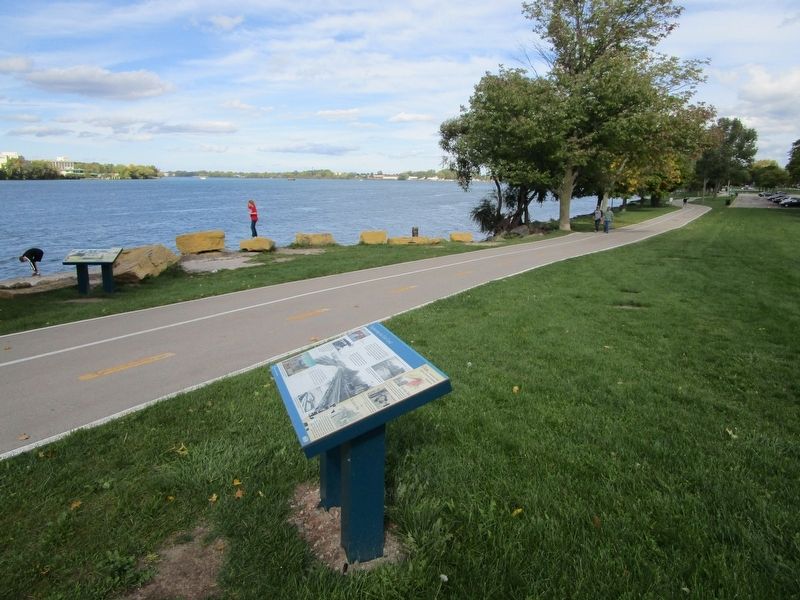
Location. 43° 0.882′ N, 78° 53.793′ W. Marker is in Tonawanda, New York, in Erie County. Marker can be reached from Niagara Street (New York State Route 266) 0.1 miles north of Gibson Street. Marker is on the riverwalk in Niawanda Park. It is along Niagara Street, opposite Gibson Street. Touch for map. Marker is in this post office area: Tonawanda NY 14150, United States of America. Touch for directions.
Other nearby markers. At least 8 other markers are within walking distance of this marker. Grand Island Ferry (a few steps from this marker); The Brewery (about 700 feet away, measured in a direct line); Erie Canal Site (approx. ¼ mile away); Great Ships of the Niagara (approx. ¼ mile away); Tonawanda Veterans Memorial (approx. half a mile away); Westward to Buffalo (approx. 0.6 miles away); Dedicated to the Memory (approx. 0.6 miles away); To The Glory of God and in Grateful Remembrance (approx. 0.6 miles away). Touch for a list and map of all markers in Tonawanda.
Credits. This page was last revised on October 9, 2016. It was originally submitted on October 9, 2016, by Anton Schwarzmueller of Wilson, New York. This page has been viewed 366 times since then and 20 times this year. Photos: 1, 2. submitted on October 9, 2016, by Anton Schwarzmueller of Wilson, New York.

