Brownsville in Cameron County, Texas — The American South (West South Central)
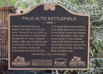
Palo Alto Battlefield
- 1846 -
English:
On May 8, 1846 United States and Mexican troops clashed on the Palo Alto prairie. This was the first major battle in a two-year long conflict (U.S.-Mexican War) that ended with the Treaty of Guadalupe Hidalgo in 1848, under which Mexico ceded a large territory to the U.S. that included parts of California, Colorado, Utah, Arizona, Nevada, New Mexico and Texas.
El 8 de mayo de 1846 las tropas de los Estados Unidos y México se enfrentaron en la pradera de Palo Alto. Esta fue la primera batalla importante del conflicto (Guerra México - Estados Unidos) que terminaria con el Tratado de Guadalupe Hidalgo en 1848 donde México llegaria a ceder una gran region a los Estados Unidos que incluia partes de California, Colorado, Utah, Arizona, Nevada, Nuevo México y Tejas.
Historical Trail Sponsors
Brownsville City - On the border by the sea
Brownsville Historical Association - Brownsville Heritage Complex
Preserve America - Explore and Enjoy Our Heritage
Brownsville Community Improvement Corporation - Funding quality of life projects
Topics. This historical marker is listed in this topic list: War, Mexican-American. A significant historical date for this entry is May 8, 1846.
Location. 26° 0.877′ N, 97° 28.861′ W. Marker is in Brownsville, Texas, in Cameron County. Marker is at the intersection of Paredes Line Road and SH 550, on the right when traveling north on Paredes Line Road. The marker is near to the pedestrian entrance gate to the Palo Alto Battlefield National Historic Park. Touch for map. Marker is in this post office area: Brownsville TX 78526, United States of America. Touch for directions.
Other nearby markers. At least 8 other markers are within 4 miles of this marker, measured as the crow flies. The Battle of Palo Alto (a few steps from this marker); Historic Battlefield Trail (a few steps from this marker); a different marker also named Palo Alto Battlefield (approx. 0.2 miles away); Border War / Guerra de fronteras (approx. half a mile away); Chosen Ground / Arena decidida (approx. 0.6 miles away); Cavalry Charge / Se lanzaba la caballería (approx. 0.7 miles away); Three Hundred Supply Wagons / Trescientas carretas de viveres (approx. 0.9 miles away); "Rancho Viejo" (approx. 3.2 miles away). Touch for a list and map of all markers in Brownsville.

Photographed By Ruben Reyna, National Park Service
2. Palo Alto Battlefield Marker
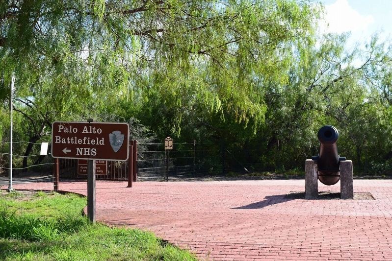
The marker is almost at center in this view, to the left of the cannon. Although the signage here says that the Palo Alto Battlefield is a National Historic Site, it has been upgraded recently to a National Historic Park.
Credits. This page was last revised on July 18, 2018. It was originally submitted on October 11, 2016, by J. Makali Bruton of Accra, Ghana. This page has been viewed 519 times since then and 41 times this year. Photos: 1, 2. submitted on October 11, 2016, by J. Makali Bruton of Accra, Ghana.
