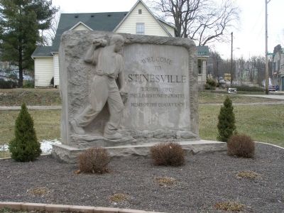
Stinesville in Monroe County, Indiana — The American Midwest (Great Lakes)
Stinesville Limestone Industry
Erected 1996 by the Indiana Historical Bureau and Danny Phelix Jacobs. (Marker Number 53.1996.1.)
Topics and series. This historical marker is listed in these topic lists: Industry & Commerce • Natural Resources. In addition, it is included in the Indiana Historical Bureau Markers series list. A significant historical year for this entry is 1827.
Location. 39° 17.931′ N, 86° 39.126′ W. Marker is in Stinesville, Indiana, in Monroe County. Marker is on West Main Street near West Railroad Street. Located in the town park, just west of the tracks and the town center. Touch for map. Marker is in this post office area: Stinesville IN 47464, United States of America. Touch for directions.
Other nearby markers. At least 5 other markers are within 4 miles of this marker, measured as the crow flies. Ferry Bridge (approx. 2.7 miles away); The Springhouse (approx. 3.2 miles away); The Pedens: First Family of McCormick's Creek (approx. 3.2 miles away); The Ten O'Clock Line (approx. 4 miles away); Camp Hughes (approx. 4 miles away).
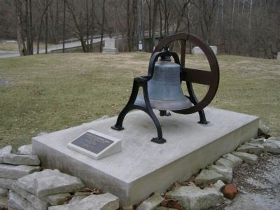
More about this marker. It is in the Victor Oolitic Park.
Also see . . . Stinesville Commercial Historic District. NHRP nomination form. (Submitted on October 31, 2020, by Larry Gertner of New York, New York.)
Credits. This page was last revised on October 31, 2020. It was originally submitted on May 4, 2007, by Christopher Light of Valparaiso, Indiana. This page has been viewed 2,539 times since then and 38 times this year. Photos: 1. submitted on May 4, 2007, by Christopher Light of Valparaiso, Indiana. 2. submitted on February 1, 2008, by Christopher Light of Valparaiso, Indiana. 3. submitted on May 4, 2007, by Christopher Light of Valparaiso, Indiana. 4, 5. submitted on February 1, 2008, by Christopher Light of Valparaiso, Indiana. • J. J. Prats was the editor who published this page.


