McNair near Herndon in Fairfax County, Virginia — The American South (Mid-Atlantic)
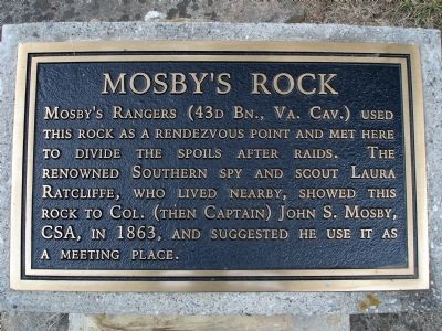
Mosby's Rock
Topics. This historical marker is listed in this topic list: War, US Civil. A significant historical year for this entry is 1863.
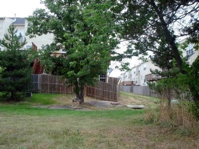
Location. Marker has been reported missing. It was located near 38° 56.692′ N, 77° 25.033′ W. Marker was near Herndon, Virginia, in Fairfax County. It was in McNair. Marker could be reached from Squirrel Hill Road. Marker can be accessed from Mt Pleasant Baptist Church's overflow parking lot at the terminus of Squirrel Hill Road. Marker is located in the common area of the McNair Farms development behind a row of townhouses located on Big Boulder Road. Touch for map. Marker was in this post office area: Herndon VA 20171, United States of America. Touch for directions.
Other nearby markers. At least 8 other markers are within walking distance of this location. A different marker also named Mosby’s Rock (about 700 feet away, measured in a direct line); Historical Site of Mount Pleasant Baptist Church (approx. 0.4 miles away); Frying Pan Meeting House (approx. 0.4 miles away); Pin Oak (approx. 0.4 miles away); a different marker also named Frying Pan Meeting House (approx. 0.4 miles away); a different marker also named Frying Pan Meeting House (approx. 0.4 miles away); Civil War at Frying Pan Spring Meeting House (approx. 0.4 miles away); The 4-H Building (approx. 0.6 miles away). Touch for a list and map of all markers in Herndon.
Also see . . . Herndon-area woman saves Mosby. Washington Times article regarding Laura Ratcliffe and Mosby's Rock. (Submitted on August 5, 2008.)
Additional commentary.
1. Finally found it!
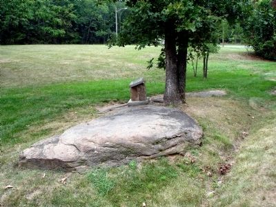
I went down McNair Farms and I found Mt. Pleasant Church and the marker. Where exactly the stone was, that was a different story. A big problem was that the street sign for the corner of McNair and Squirrel Hill was BACKWARDS which led me to believe that McNair was Squirrel Hill. An easy description is that when you find Mt. Pleasant there is an entrance to the parking lot and left of the entrance is a small road roped off. That is Squirrel Hill, go down it to reach the gravel parking lot for Mt. Pleasant and the rock is under a tree across the grass in between the townhouses.
— Submitted September 15, 2013, by Jay Richardson of Martinsburg, West Virginia.
2. Marker missing
At some time since this summer, the marker has been removed.
— Submitted November 30, 2020, by Jon Grantham of Herndon, Virginia.
Credits. This page was last revised on September 21, 2023. It was originally submitted on August 5, 2008. This page has been viewed 7,902 times since then and 440 times this year. Photos: 1, 2, 3. submitted on August 5, 2008. • Craig Swain was the editor who published this page.


