Near Stevens Crossing in Emanuel County, Georgia — The American South (South Atlantic)
Pine Barren Crossroads
A Junction of Sherman's Right Wing
— March to the Sea Heritage Trail —
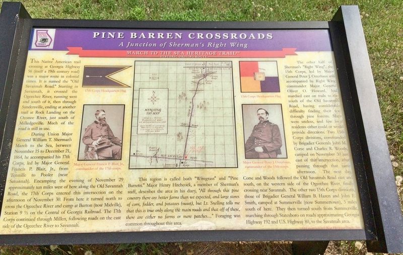
During Union Major General William T. Sherman's March to the Sea, between November 15 to December 21, 1864, he accompanied his 17th Corps, led by Major General Francis P. Blair, Jr., from Tennille to Pooler (near Savannah). Encamping the evening of November 29 approximately ten miles west of here along the Old Savannah Road, the 17th Corps entered this intersection on the afternoon of November 30. From here it turned north to cross the Ogeechee River and camp at Burton (now Midville), Station 9 ½ on the Central of Georgia Railroad. The 17th Corps continued through Millen, following roads on the east side of the Ogeechee River to Savannah.
This region is called both "Wiregrass" and "Pine Barrens." Major Henry Hitchcock, a member of Sherman's staff describes the area in his diary, "All through this pine country there are better farms than we expected, and large stores of corn, fodder, and potatoes (sweet), but Lt. Snelling tells me that this is true only along the main roads and that off of these, there are either no farms or mere patches..." Foraging was common throughout this area.
The other half of Sherman's "Right Wing", the 15th Corps, led by Major General Peter J. Osterhaus and accompanied by Right Wing commander Major General Oliver O. Howard had marched east on trails to the south of the Old Savannah Road, having considerable difficulty finding their way through pine forests. Maps were useless, and few local residents either could or would provide directions. Two 15th Corps divisions, commanded by Brigadier Generals John M. Corse and Charles R. Woods, camped on November 30 just east of this intersection, after passing through that same afternoon. The next day, Corse and Woods followed the Old Savannah Road east and south, on the western side of the Ogeechee River, finally crossing near Savannah. The other two 15th Corps divisions those of Brigadier General William B Hazen and John E. Smith, camped at Summerville (now Summertown), 3 miles south of here. They then turned south from Summerville, marching through Statesboro on roads approximating Georgia Highway 192 and U.S. Highway 80, to the Savannah area.
[Photo captions]
Top left: 17th Corps Headquarters Flag
Bottom left: Major General Francis P. Blair, Jr., commander of the 17th corps.
Middle: Marching Day Map
Top right: 15th Corps Headquarters Flag
Bottom right: Major General Peter J. Osterhaus, commander of the 15th corps.
Erected 2002 by Georgia Civil War Heritage Trails, Inc. (Marker Number R18.)
Topics and series. This historical marker is listed in these topic lists: Horticulture & Forestry
• War, US Civil. In addition, it is included in the Georgia Civil War Trails, and the Sherman’s March to the Sea series lists. A significant historical date for this entry is November 15, 1864.
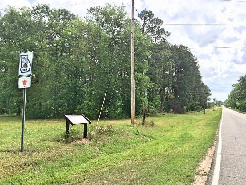
Location. 32° 47.052′ N, 82° 14.67′ W. Marker is near Stevens Crossing, Georgia, in Emanuel County. Marker is at the intersection of Old Savannah Road and East Main Street (Georgia Route 56), on the left when traveling east on Old Savannah Road. Touch for map. Marker is at or near this postal address: Old Savannah Road, Midville GA 30441, United States of America. Touch for directions.
Other nearby markers. At least 8 other markers are within 11 miles of this marker, measured as the crow flies. Sherman at Midville (approx. 2˝ miles away); Summerville (approx. 3.2 miles away); The Savannah Road (approx. 5.2 miles away); Sherman at the Jones Plantation (approx. 6.7 miles away); Bark Camp Church (approx. 7.2 miles away); a different marker also named Bark Camp Church (approx. 7.3 miles away); Old Town Plantation (approx. 9.7 miles away); The 20th Corps (approx. 10.9 miles away).
Credits. This page was last revised on December 7, 2018. It was originally submitted on May 8, 2017, by Mark Hilton of Montgomery, Alabama. This page has been viewed 577 times since then and 46 times this year. Photos: 1, 2. submitted on May 8, 2017, by Mark Hilton of Montgomery, Alabama.

