Near Plummer in Benewah County, Idaho — The American West (Mountains)
Heyburn State Park
the Oldest State Park in the Pacific Northwest
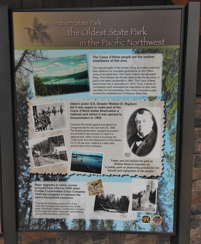
The Coeur d’Alene people are the earliest inhabitants of this area.
The natural wealth of the forests, rivers, and lakes sustained their existence for countless generations on five million acres of ancestral land. Their lifestyle was forever altered with the discovery of gold in the Idaho pan handle in 1860. The Coeur d’Alene were forced onto a reservation in 1873. Then, a series of concessions each downsized the reservation as their land was taken for homesteading. One of the concessions also involved the establishment of Heyburn State Park.
Idaho’s junior U.S. Senator Weldon B. Heyburn felt it was urgent to make part of the Coeur d’Alene Indian Reservation a national park before it was opened to homesteaders in 1909.
Theodore Roosevelt agreed and signed the Congressional Act into law April 20, 1908. The federal government changed its position and decided it did not want to make it a national park. Idaho chose to purchase the 7,838 acres from the Department of the Interior for $1.45 per acre, making it a state park, and the first in the northwest.
Today, you can explore the park as Weldon Heyburn intended, as “a public park or pleasuring ground for the benefit and enjoyment of the people.”
Major upgrades in visitor access occurred from 1934 to 1942 when Civilian Conservation Corps Company 1995 was assigned to enhance the park’s recreational resources.
Their labors included the construction of the Chatcolet campground, development of the water distribution system, construction of many of the trails and roads in the park, and building many of the structures still in use.
Erected by Idaho State Parks.
Topics and series. This historical marker is listed in these topic lists: Government & Politics • Native Americans • Parks & Recreational Areas • Settlements & Settlers. In addition, it is included in the Civilian Conservation Corps (CCC), and the Former U.S. Presidents: #26 Theodore Roosevelt series lists.
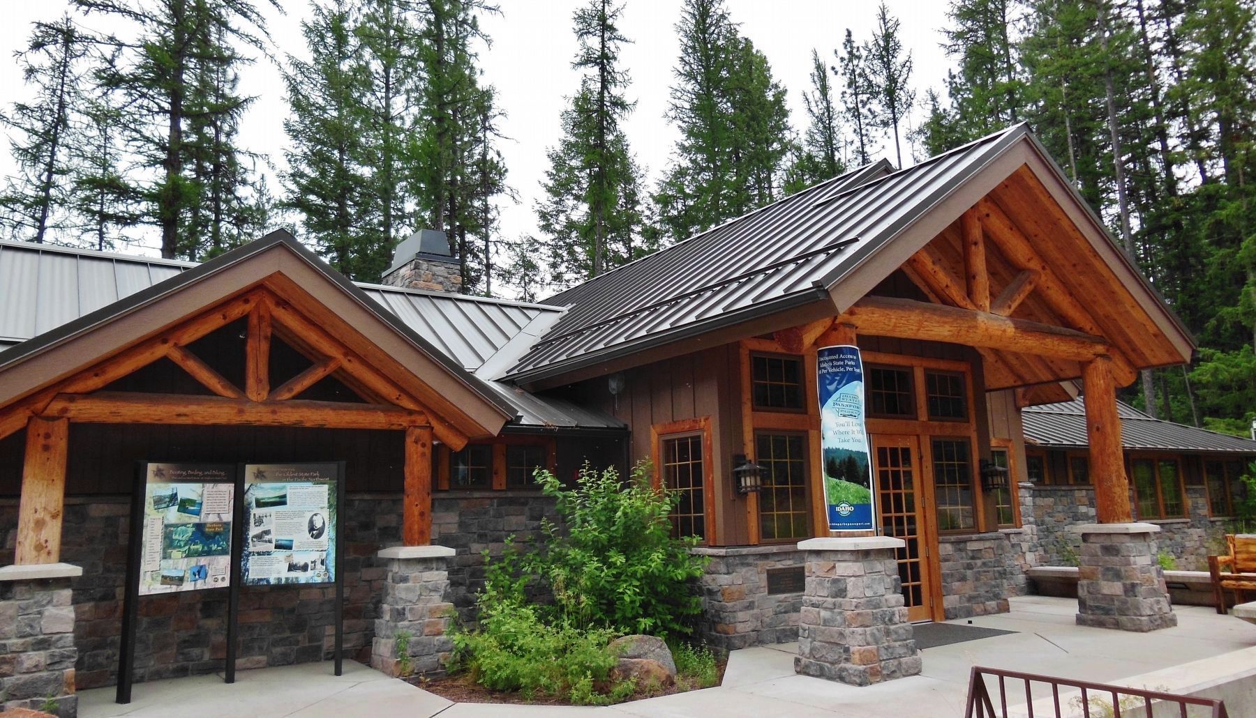
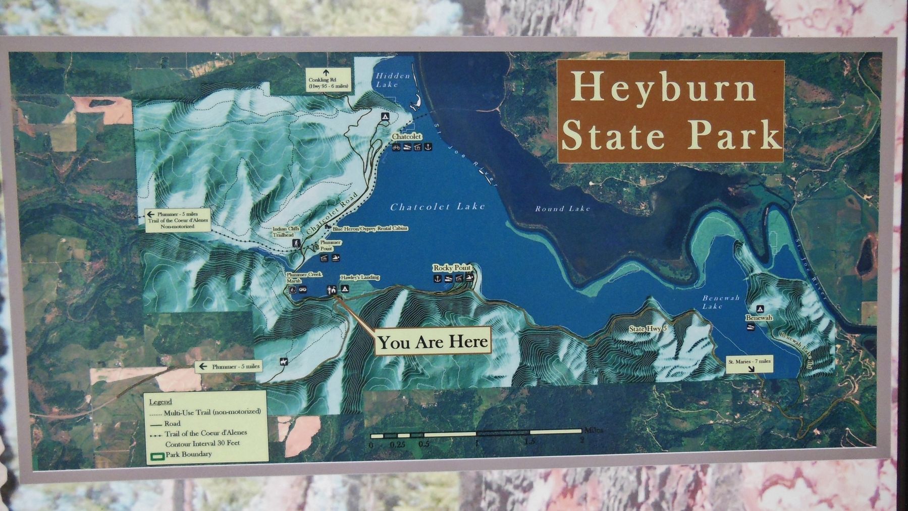
Location. 47° 21.231′ N, 116° 46.345′ W. Marker is near Plummer, Idaho, in Benewah County. Marker is on Chatcolet Road, 6˝ miles east of U.S. 95, on the right when traveling west. Marker is located in front of the Heyburn State Park Visitor Center. The Visitor Center is on Chatcolet Road, just north of Idaho State Highway 5, about 6.5 miles east of US Highway 95. Touch for map. Marker is at or near this postal address: 57 Chatcolet Lower Road, Plummer ID 83851, United States of America. Touch for directions.
Other nearby markers. At least 8 other markers are within 9 miles of this marker, measured as the crow flies. Once an area of many uses by the Coeur d'Alene People
(approx. 0.4 miles away); Hnpetptqwe'n Wayside (approx. 2.1 miles away); Saint Joseph Indian Mission (approx. 4.4 miles away); The Mullan Road (approx. 6.1 miles away); Submerged Valley (approx. 6˝ miles away); John Mullan (approx. 9 miles away); Mullan Trail Road (approx. 9 miles away); Splash Dam at Hobo Creek (approx. 9.1 miles away).
Also see . . .
1. Heyburn State Park History.
Heyburn State Park was created from the Coeur d' Alene Indian Reservation by an act of Congress, on April 20, 1908. The deed, signed by President William Howard Taft, granted 5,505 acres of land and 2,333 acres of water to the State. The park was named in honor of U.S. Senator W.B. Heyburn of Idaho. (Submitted on November 21, 2017, by Cosmos Mariner of Cape Canaveral, Florida.)
2. Weldon Brinton Heyburn.
During his career, he opposed Gifford Pinchot's call for national forests because he didn't agree with the federal government controlling vast amounts of land in western states. He also fought Theodore Roosevelt on many of the Progressive Era ideas such as an 8-hour work day and child welfare laws. Heyburn is best remembered for introducing the bill which became the Pure Food and Drug Act in 1906. (Submitted on November 21, 2017, by Cosmos Mariner of Cape Canaveral, Florida.)
Additional keywords. Forced removal of Native Americans
Credits. This page was last revised on October 18, 2020. It was originally submitted on November 21, 2017, by Cosmos Mariner of Cape Canaveral, Florida. This page has been viewed 295 times since then and 11 times this year. Photos: 1, 2, 3. submitted on November 21, 2017, by Cosmos Mariner of Cape Canaveral, Florida. • Bill Pfingsten was the editor who published this page.


